Navigate and explore with detailed maps and real-time updates. Find points of interest, view construction progress, and get directions. Stay informed with ongoing community changes and location-based services.
by RIVER ISLANDS DEVELOPMENT, LLC★ 5.02 ratingsNavigationFreeData updated 2026-09-06
Navigate using augmented reality and zoomable offline maps. View interactive points of interest including public transport, restaurants, and hospitals. Access city tips, safety advice, and shopping guides.
Navigation allows users to view maps, track location, and receive turn-by-turn directions. Enable offline maps, set waypoints, and share coordinates. Sync with compatible devices for real-time tracking and messaging.
Provide turn-by-turn navigation for skiers and snowboarders. Set personalized in-ear audio directions. Use Siri Shortcuts to activate navigation and specify destinations. Track location and receive real-time guidance on the mountain.
Explore , discover landmarks, navigate city streets
Explore self-guided walking tours of the city with detailed maps and curated routes. Find attractions, hidden gems, and local highlights. Navigate using an interactive map to locate points of interest and plan your path.
Explore locations with augmented reality overlays. Access offline maps and regional details. View interactive points of interest including transport hubs and attractions. Plan daily itineraries and budget-friendly accommodations.
Explore , discover landmarks, navigate city streets
Explore self-guided walking tours with detailed city maps. Navigate attractions and hidden spots. Locate points of interest and plan routes. Track your progress and save favorite locations. Share tour experiences with others.
Find restaurants and grocery stores with location-based search and reviews. Order meals for or pickup. View nutritional information and prayer times. Join community forums to share recipes and travel recommendations.
Explore self-guided walking tours with detailed city maps. Navigate to attractions and hidden spots. Set walking routes and track progress. Receive turn-by-turn directions and location-based recommendations. Share maps and routes with others.
The app provides details and photos for Hoover Dam sights, including the Intake Towers and Power Plant. Audio narrations are available for each location.
Plan routes and navigate metro system with real-time updates and step-by-step directions. View station maps, check arrival times, and get service alerts. Search for nearby points of interest and switch between metro lines.
Navigate cities with zoomable offline maps and GPS. View interactive points of interest including public transport, restaurants, and hospitals. Access shopping guides, nightlife info, and city tips.
Track wildfires in real time with maps showing current fire locations and spread. Receive alerts from verified sources including current and former firefighters. View detailed reports and updates from first responders and reporters.
Find available parking lots on campus using live lot info and interactive maps. Filter options let you search by permit type and time. View lot details including location and availability. Navigate to selected lots with directions.
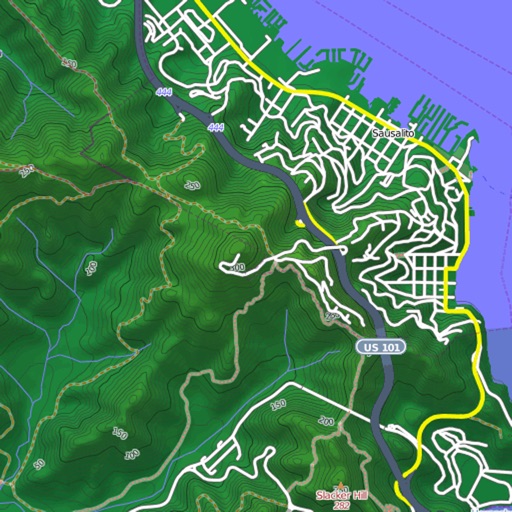
View and download detailed maps with topographical hillshading and contour lines. Store maps for offline use. Navigate using detailed terrain features. Find hiking trails, ski runs, and back streets.
Find and reserve private mooring buoys with real-time availability. View detailed information about public buoys, including location, park details, payment instructions, and buoy counts.
Explore city streets with self-guided walking tours covering famous landmarks and hidden spots. Use an interactive map to navigate, find points of interest, and track your route. Save favorite locations and receive turn-by-turn directions.
Explore self-guided walking tours of the city with detailed routes to famous attractions and hidden spots. Use the built-in map to navigate, find points of interest, and track your progress.
View detailed transit maps for , RER, and tram systems. Plan routes and navigate easily. Convert currencies and access travel tips. Find nearby attractions and landmarks. Save time and money with accurate transportation information.