
SEAiq Pilot
Sakhalin, LLC
Navigation for pilots on waterways.
The app supports S-57, S-63, iENC, and BSB/KAP chart formats. It includes features such as predicted vessel display, docking aids, and NMEA/AIS record and playback.

Showing 1–20 of 1,000 ranked alternatives.
Sakhalin, LLC
Navigation for pilots on waterways.
The app supports S-57, S-63, iENC, and BSB/KAP chart formats. It includes features such as predicted vessel display, docking aids, and NMEA/AIS record and playback.

Sakhalin, LLC
Navigate with chart support and AIS data
View nautical charts in S-57, S-63, iENC, and BSB/KAP formats. Use external NMEA/AIS data over WiFi. Display official HO S-57/S-6 charts. Navigate river, channel, and harbor routes. Access real-time positioning and vessel tracking data.

Sakhalin, LLC
Download charts and navigate waters
Navigation allows users to view and download marine charts automatically from NOAA and US Army Corps of Engineers. Create waypoints, routes, and tracks. Use night color modes and anchor alarm. Access weather data and chart measuring tools.

Sakhalin, LLC
Load charts and navigate seas
Navigation allows users to load custom charts in S-57, S-63, iENC, BSB, and KAP formats. It automatically downloads NOAA charts and raster maps. Users can create waypoints, routes, and tracks. Night color modes and anchor alarms are available.

Flightradar24 AB
Track flights and view real-time aircraft data
Track aircraft movements in real-time on a detailed map. View details including destination, aircraft type, and altitude. Use device camera to identify planes and check status. Receive alerts for changes and delays. Share data with others.

Pilot Travel Centers, LLC
Find fuel, food, and rewards on
Find gas stations, restaurants, and car washes near your location. Track rewards and earnings. View maps and directions. Receive real-time updates on fuel prices and promotions. Manage account settings and redeem rewards.

Trucker Path Inc.
Find stops and fuel prices
Find stops, weigh stations, and fuel prices across the US and Canada. View chain stops and compare fuel costs. Receive GPS navigation tailored for trucks. Share location with other drivers. Track fuel savings and route efficiency.

Mosaic S.r.l.
Track flights in real time worldwide
Track real-time positions and receive updates on status. View paths, altitudes, and speeds. Monitor family or friend flights for arrival and departure times. Set alerts for changes and airport pickups.


Tim O's Studios, LLC
Track speed in mph, km/h, or knots
Displays current speed in mph, km/h, or knots. Features a large, clear indicator with adjustable transparency for better accuracy. Uses device hardware to estimate speed. No additional features or connectivity options.

Kramer Concepts, LLC
Track bus and train arrivals in real
View estimated arrival times for buses and trains with route names, directions, and distances. Receive updates via Apple Watch for saved stops. Track real-time schedules for CTA routes.

Sporty's Pilot Shop
Calculate data and track position
Calculate -related conversions, fuel consumption, and navigation metrics. Perform arithmetic operations and unit conversions. Track time, distance, and speed. Sync with Apple Watch for real-time updates.

San Francisco Bay Area Rapid Transit District
Plan trips, track train departures, receive service
Plan trips with real-time train departures and service alerts. Find fastest routes using and connecting transit. View schedules and station information. Get trip details including transfers and estimated arrival times.

Trucker Guide LLC
Navigate routes and avoid low bridges
Plan routes with -specific GPS navigation. Avoid low bridges, weight restrictions, and "No " zones. Access over 450,000 points of interest. View real-time traffic and road closures. Save and share custom routes. Track fuel and maintenance schedules.

Sporty's Pilot Shop
Access content and practice tests
Access aviation courses, including FAA handbooks, FAR/AIM, and practice tests. Watch HD/4K videos. Sync with Apple devices. Track progress through interactive lessons. Earn a certificate with structured course content.

Ansgar Vollmer Und Till Knorr
Explore cities with maps
Explore transit routes and schedules for major cities worldwide. View detailed maps with station locations, line connections, and real-time updates. Find nearby stations and plan journeys using integrated maps.

BEKART TECH BILISIM TEKNOLOJI INSAAT TICARET LIMITED SIRKETI
Find direction and prayer times
Find direction with accurate guidance. Set vibration or sound alerts when aligned. View prayer times and locations. Track daily prayers and receive reminders. Share location with others for prayer coordination.

Mapway Inc.
Navigate with official data
Plan journeys using the official TfL , Night , and Rail Network. View multiple map styles including a geographical bonus map. Navigate offline. Find station details and service updates. Track real-time arrivals and departures.

Rohan Mehta
Track arrivals, view maps, set alerts
Track and bus arrivals with real- data from the MTA. View arrival times on home and lock screen widgets. Save favorite stations for quick access. Check service alerts for delays and changes. Compare transfer times between trains.
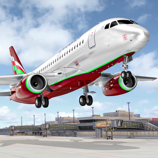
Sohail Sarwar
Fly planes, perform stunts, complete missions
Control an to perform stunts and navigate through checkpoint rings. Transport passengers between cities and complete assigned tasks. Customize aircraft settings and manage in-game missions.
Apps are ranked by functional similarity, category fit, rating confidence, and popularity.