

Apps Like Qastor for iPhone and iPad
Qastor screenshots
Ranked alternatives
Showing 341–360 of 1,000 ranked alternatives.


Iphigénie | Offline Maps
Iphigenie
Navigate with detailed topographic maps
Plan hikes by downloading detailed topographic maps for offline use. Access IGN, SwissTopo, and OpenTopo basemaps. Track routes, view elevation data, and navigate with precise geographic information. Share maps and waypoints with others.


FingerCMS
Deeplet Technology Corp.
Monitor and control DVRs remotely.
The app enables remote monitoring and control of DVRs using H.264 decode capability and dual-streaming video. It offers features like two-way audio, alarm input monitoring, and PTZ control with versatile display formats.

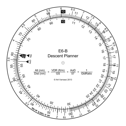
E6B Descent Planner
Arthur Varrassi
Circular slide rule for descent planning.
The app offers a functional circular slide rule for descent planning. It calculates top of descent distance, angle, rate, glide ratio, and maximum glide distance.

Aviation Weather: METAR & TAF
Dora.net LLC
Track and TAF reports in real time
Access real-time and TAF reports for accurate aviation weather data. View wind speed, visibility, temperature, and cloud coverage. Set location preferences and receive updates. Share reports via email or messaging.

Nav Camera
Craig Hunter
Record photos and videos with data overlays
Record photos and videos with real-time data overlays. Use augmented reality for navigation. Access proven navigation and image processing technologies. Capture geospatial data during recordings. Share media with embedded location and time stamps.

Toronto Bikes — A One-Tap Toronto Bike Share App
Urban Apps
Find stations, check availability, navigate to them
Locate nearby docking stations with distance and direction. View available and docks. Use full-map mode to check docks at destinations. Set a ride timer to track rentals and avoid late fees.

FlyFishFinder Fly Fishing Maps
flyfishfinder, LLC
Find fly water by species
Identify fly locations for over 100 species including trout varieties. Input location to find suitable waters. View species-specific information. Track conditions and water details. Share locations with other anglers.


Bike Tracks
Core Coders Ltd
Record rides and save maps offline
Record cycling rides with offline maps and GPS tracking. Add routes via GPX files or existing rides. Overlay routes on maps. View climb categories and ride history without internet. Import photos and attach to rides. Sync with Health .
POI Nearby
Simon Long
Manage custom points of interest easily.
The app allows users to manage custom points of interest. Users can add their own lists of POIs using the standard CSV data format.

Seawatch24 Marine Traffic AIS
Brian Bach Mortensen
Track ships in real time and view
Track real-time vessel movements and access detailed maritime data. Search for ships by name, MMSI, or IMO. View ship details, photos, and voyage information. Customize maps with overlays to identify ports, shipping lanes, and navigation markers.
Meet Star Gazers
Sujay PATIL
Find stargazing spots and track sky quality
Find stargazing locations based on distance, sky quality, and observation type. Check horizon clearance, parking space, and power availability. Plan trips with detailed location details and accessibility options.

Digital Speedometer: HUD Speed
Youness Zaouda
Track with real-time precision
Track with GPS-based real-time analytics. View current , historical data, and location markers. Set limits and receive alerts when exceeded. Export data for review and share results.
How we rank alternatives
Apps are ranked by functional similarity, category fit, rating confidence, and popularity.