View maps in three different styles with six customizable settings. Long press to access map options. Search for locations and streets. Navigate with fullscreen map interface.
by Corvin Hartmann★ 4.6294 ratingsNavigation$2.99Data updated 2026-09-06
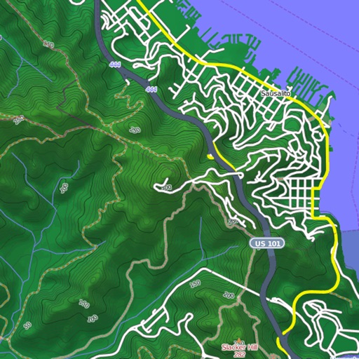
View and download detailed maps with topographical hillshading and contour lines. Store maps for offline use. Navigate using detailed terrain features. Find hiking trails, ski runs, and back streets.
Track visited countries and US states with a world map and continental ratio display. Share maps on social media. Compare maps with friends. Enable classic interface for older design preference.
Search properties for sale in Wisconsin and the Upper Peninsula of Michigan. View detailed listings with photos, descriptions, price, taxes, estimated mortgage, and maps. Filter by location or enter specific addresses.
The app offers turn-by-turn navigation with worldwide map coverage from eight different providers. It features fast map rendering, offline map mode with unlimited tile storage, and real-time traffic information.
Navigate with real-time traffic updates and route guidance. Access map home tabs for bookmarks, transit, and . Search locations, buses, and subways in one bar. Book services directly through the .
Navigation provides offline global maps for iPhone and iPad. Users can draw routes, view elevation profiles, and access detailed terrain maps without internet. Hikers and cyclists benefit from specialized route networks and clear map details.
Navigate using View with compass and screen capture. Tap blue lines for view, blue points for famous places, yellow points for businesses, and sea markers for underwater panoramas. Switch between map and View views.
Navigate with smart route planning and real-time traffic updates. Access 3D offline maps and precise estimated time of arrival. Receive speed camera warnings and traffic alerts. Support for , HGV, RV, and other large vehicles.
Track travel locations on a map. Draw routes and mark destinations. View visual maps of traveled paths. Save and revisit travel history. Share trip details with others. Customize map views and annotations.
Distances between waypoints or calculate surface areas using map polygons. Set waypoints by tapping and holding. Choose units like kilometers, miles, or nautical miles. Access settings to change map type or view the manual.
Navigate using a 3D map with interactive routes. real-time imagery of any location. Calculate distances and areas between points. Explore landmarks and locations globally.
Track and save GPS locations for cars, hotels, and other places. View maps in Roadmap, Satellite, Hybrid, and Terrain modes. Share locations quickly and search for points of interest with GPS navigation.
Convert geographic coordinates to map locations and vice versa. Input latitude and longitude to place a red pin on the map. Long press a map point for 0.5 seconds to display its coordinates.
Organize by calendar and map. View weekly or daily photo collections. Check location and date details in full screen. Search by location or nearby areas.
Plan your visit to the Zoo or Zoombezi Bay with a GPS map. Find animal exhibits, ride locations, food vendors, and restrooms. Save favorite spots and navigate between attractions.
Provides detailed subway maps with English and Chinese language support. Displays real-time metro lines and stations. Includes route planning, GPS navigation, and offline functionality. Offers street maps for navigation.
Create a personalized map marking visited provinces and prefectures in . Categorize locations as visited, planned, or world heritage sites. Track statistics and attach photos and notes to specific places.
Explore a 3D model of the with relief details. Navigate through a menu to access political and physical maps. View over 100 geographic features and weather data. Access factual information about global locations.
Track and save locations with map marking and note-taking. Record trails and tracks. Set land boundaries and access points. Share coordinates and view area details. Sync with trail camera zones and tree stand spots.
Find public machines worldwide. Filter locations by machine type, operator, or location. Save favorites. View recent activity near you. Add or remove machines to update the map. Comment on machine conditions.