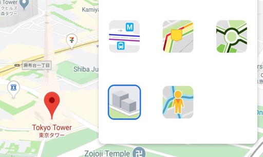
View maps in three different styles with six customizable settings. Long press to access map options. Search for locations and streets. Navigate with fullscreen map interface.
by Corvin Hartmann★ 4.6295 ratingsNavigation$2.99Data updated 2026-09-15
Browse a list of popular and hidden spots near you. Explore by category to find restaurants, bars, or activities. View options on an interactive map with directions. Save favorite places to plan future outings.
Manage trips by reviewing and canceling upcoming or completed rides. View real-time vehicle ETAs and track bus location on a map. Receive notifications for trip updates and schedule adjustments.
The app provides worldwide marine and outdoor maps, satellite imagery, and terrain overlays. It includes local marine weather forecasts and community information for boaters.
Find drinking fountains on a map and receive directions to the nearest one. View locations in cities like New York, Florence, and Amsterdam. Refresh water without carrying a bottle.
The app imports planned routes from TrailRunner mini and follows their course. It allows users to switch map styles, use offline mode, and share routes via email.
Save locations by tapping to add notes, tags, and categories. Plan routes with multiple points and choose navigation modes. Track location history and view saved places on a map.
The app displays a user's timetable and campus maps for three locations. It lists upcoming events, allows saving personal events, and provides access to Rec Centre schedules and library information.
The app determines if a parking ticket is needed based on the user's location. It shows parking zone colors and allows ticket purchases within the app.
Create interactive logs by mapping photos to locations using embedded GPS or manual input. Annotate images with text, tags, and notes. Share mapped journeys and view detailed location-based stories.
Track visited countries on an interactive world map. Tap to mark locations and view totals and global percentage. Plan future trips and save records with a simple, focused interface.
Provides navigation with detailed vector maps that support zooming at any level. Includes location-based points of interest and allows users to save money on roaming costs.
View detailed trilingual maps of Hong Kong with official Lands Department data. Access offline topographic maps for navigation. Locate public facilities and geospatial information. Search for addresses and points of interest.
Provides maps for navigation without internet connection. Includes detailed vector maps with zoom capabilities. Displays points of interest and allows location-based searches. Enables route planning and directions.
Navigate Lake Norman with maps showing marinas, boat launches, restaurants, and other points of interest. Save favorite locations for quick access. Create custom places on the map for specific activities like boating or relaxation.
Explore locations, book tours, and discover favorites
Explore San Francisco with a user-friendly map and offline access. Book tours and discover local favorites. View insider recommendations and access curated guides. Share favorites with others.
Provide maps for navigation without internet connection. Zoom into detailed vector maps with continuous updates. Locate points of interest and navigate without roaming charges. Save data by avoiding international fees.
Navigate offline with turn-by-turn directions and map views. Set waypoints and track routes. Use for orientation. Share locations and receive directions without internet. Sync with other devices for real-time updates.
Track locations on a map and view stops along the route. Navigate between Alpine Resort and downtown with real-time updates. Purchase tickets and plan stops to avoid parking. Sync with schedules for accurate arrival times.