

Apps Like Cartograph Maps 2 for iPhone and iPad
Cartograph Maps 2 screenshots
Ranked alternatives
Showing 101–120 of 1,000 ranked alternatives.

Canyoneer
Brice Pollock
View canyons, explore routes, share adventures
View and explore canyons with map-based search and interest filters. Access detailed canyon information, weather, routes, and waypoints. Share canyons with friends. Download offline topo maps and stay updated with latest data.

Offline Maps: GPS Tracker GPX
SERGEI BEZDENEZHNYKH
Create and export maps with waypoints
Create and manage travel tracks with waypoints. Import and export maps in .gpx format. Use with unlimited storage. Access background barometer and pedometer data. Display color gradients for speed and height.

AIS Maps: Marine & Lake charts
Flytomap
View maps, navigate routes, track location
View detailed and with vector-based maps that remain clear at any zoom level. Pan, tilt, and rotate for an immersive experience. Purchase additional features within the for expanded functionality.

Wander: Maps & Navigation
Wander App Inc
Explore places from Instagram posts
Save places from Instagram reels and convert posts into travel itineraries by extracting mentioned locations. Explore curated official for global destinations. Download for offline access and view saved locations on a map.

Bike Tracks
Core Coders Ltd
Record rides and save maps offline
Record cycling rides with offline maps and GPS tracking. Add routes via GPX files or existing rides. Overlay routes on maps. View climb categories and ride history without internet. Import photos and attach to rides. Sync with Health .


Looking4Cache Pro
Michael Andreas May
Find geocaches and save details
Navigate using real-time maps and track geocaches with detailed location data. Store geocache information including logs, waypoints, and images locally. Import GPX files or pocket queries. Access over two million geocaches directly via API.

Houston Transit Metro
Bhanu Munjal
Find stops, save favorites, track vehicles, search
Find nearby stops with one click. Favorite stops for access across devices. Get real-time updates on vehicle schedules and positions. Search by stop name, number, or route. Maps are resizable for better control.

Geo Tracker - GPS Tracker
Ilia Bogdanovich
Track trips, record routes, share maps
Record GPS tracks of trips and analyze statistics. Share routes with friends. Use efficient background tracking to minimize battery drain. Supports Open Street Maps and Google Maps.

Georgia Pocket Maps
Alex Gugel
Download and guides for parks
Plan trips to parks with downloadable , guides, and park brochures. Access 50+ parks, 80+ , 130+ campgrounds, 400+ trails, and 63,000+ points of interest. Download newspapers and park information for offline use in areas without Wi-Fi.

EasyTrails GPS Lite
Zirak Srl
Track outdoor activities and travel details.
The app tracks outdoor activities and travel, showing distance, time, and elevation. It displays courses on a map, allows track import and sharing, and exports tracks for review on other services.
Mapster
Syzygy Research & Technology Ltd.
View maps, download trails, store routes
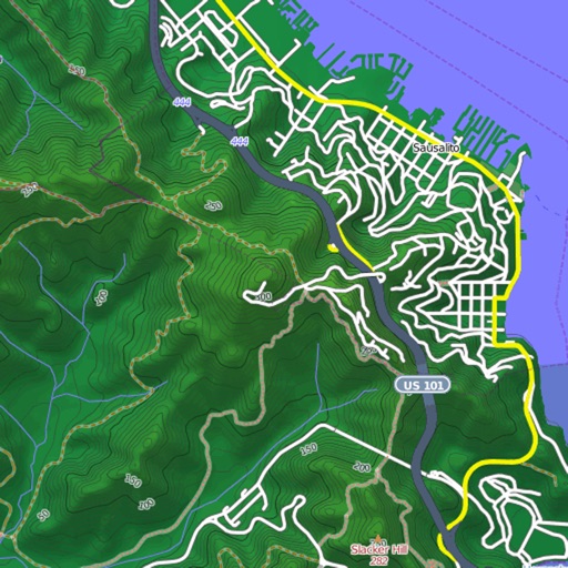
View and download detailed maps with topographical hillshading and contour lines. Store maps for offline use. Navigate using detailed terrain features. Find hiking trails, ski runs, and back streets.

GPX Reader
Jelle Vandebeeck
View GPX files on maps
View tracks, routes, and waypoints from GPX files. Display maps with options for map, satellite, or hybrid views. Open files from Safari or other apps. Support multiple formats including GPX, TCX, LOC, NMEA, and TRACK. Sync files to iCloud.


Marine Navigation-USA Lake Map
Bist LLC
Navigate with voice prompts and route manager
Access vector charts, freshwater maps, and USACE river maps. Create or import routes using GPX/KML. Receive voice prompts for navigation. View tide and current predictions. Rotate charts with text remaining upright.

Osaka Rail Map Lite
Ansgar Vollmer Und Till Knorr
Plan routes, view stations, track transfers
Navigate public transport in Central with detailed route planning and real-time GPS support. View interactive maps with high-resolution graphics and station indexes. Find transfer points and track station order on each line.

New York Rail Map Lite
Ansgar Vollmer Und Till Knorr
New York City Rail Route Map
The app provides a route map for New York City's rail and subway system. It includes a route planner, station index, lines overview, and GPS support to find nearby stations.

How we rank alternatives
Apps are ranked by functional similarity, category fit, rating confidence, and popularity.