Apps Like ArcGIS Runtime SDK Samples for iPhone and iPad
Explore maps, create layers, interact
Explore maps, layers, and features with interactive . Create and save maps. Display vector and raster data. Work with feature layers and geodatabases. Add, delete, and edit features and attachments. View code for each sample.
by ESRI★ 4.710 ratingsEducationFreeData updated 2026-09-12
Explore maps with detailed satellite views, hiking trails, and topography. Navigate transport networks and view railway routes. Access terrain analysis and seas. Customize map layers for OpenStreetMap and tile-based maps.
Turn iPad into a wireless whiteboard. Annotate PDFs and images live by projecting them to a computer on the same network. Draw, write, and highlight in real time using the iPad's screen. Share annotations directly from the web browser.
Explore anatomical structures with 3D models. Rotate, slice, and zoom to view layers. Tap labels for descriptions, audio pronunciation, and close-ups. Quiz yourself or create custom quizzes on anatomy sections.
Access editions of religious texts including Talmuds, Chumashim, Siddurim, and commentaries. Users can search, highlight, and annotate content. Sync notes across devices and view footnotes and cross-references.
Turn iPad into a for real-time annotations. Project PDFs and images to a computer via local network. Annotate live during presentations. No subscriptions or additional software required. Share annotated content directly from the browser.
Monitor radiation levels with real-time gamma energy and source analysis. View interactive dashboards for detailed metrics and tool navigation. Search for radiation data and analyze results. Sync device data for enhanced monitoring and reporting.
Access trail maps offline for all Sno-Park areas. View weather reports, event schedules, and announcements. Find grooming updates and park guidelines. Navigate trails with detailed maps and directions.
Run and TypeScript code offline using a built-in compiler. Execute code in a WebView with a console for debugging. Edit, compile, and test scripts without internet or server connection. Transpile TypeScript to locally.
Track satellite passes using augmented reality. View the International Space Station, Starlink Trains, and other satellites in real time. Overlay positions on the night sky via iPhone or iPad camera.
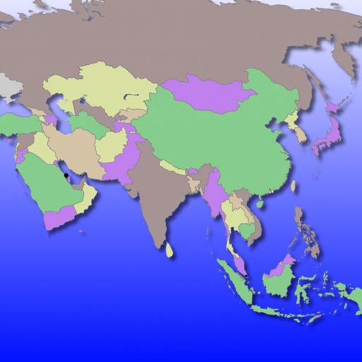
Learn Asian country locations, capitals, and flags through interactive gameplay. Zoom, scroll, and tap to explore maps. Track progress with a star system. Unlock full features with an in- purchase. No multiple choice or keyboard input.
Learn and words with detailed definitions, examples, and pronunciation support. Access offline vocabulary and performance features. Use web browser functions with internet connection.
Explore geological processes and ecological systems through an interactive 3D model. Manipulate tectonic plates, simulate volcanic eruptions, and observe erosion over time.
Allows users to plot and fit x, y data pairs. It supports curve fitting, value prediction, and kinetic data analysis. Data can be entered manually or imported from text or CSV files. Users can perform statistical analysis and generate graphs.
Create mind maps by placing ideas anywhere on an infinite canvas. Connect notes with lines and arrows. Expand pages as needed. Organize thoughts visually without linear constraints. Share or export mind maps directly.
Manage and quizzes by creating new ones from templates or existing . Edit questions, reorder sections, and undo changes. Share via QR code, email, or social media. Analyze response data with summary charts.
Test knowledge of physical , human , and maps through trivia questions. Answer multiple-choice questions, track progress, and compete with other players. Review facts and learn about natural environments, cultures, and world maps.