

Apps Like Rockd for iPhone and iPad
Explore rocks, log findings, share observations
Explore geologic features and learn about rock formations. Access location-based summaries and global geologic maps. Document observations and track your geologic journey. Contribute findings and view detailed geological information.
Rockd screenshots
Ranked alternatives
Showing 381–400 of 1,000 ranked alternatives.
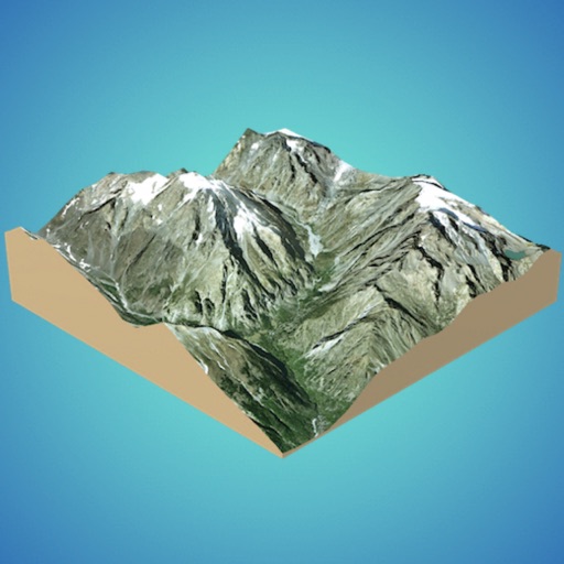
3D GIS Digital Elevation Model
Andres Narvaez
Generate 3D models from internet or cloud
Create 3D models from online sources like Bing Maps or local cloud points. Export data as CSV, TXT, STL, or OBJ. Modify models by cutting, scaling, and animating. Calculate surface areas and volumes in real-world units.

Nico & Nor Ramps Journal
WGBH Interactive
Track toy distances and record slow-motion videos
Tracks science experiments on force and motion using . Captures slow-motion videos of moving objects. Charts experimental results and records observations in a digital . Supports real-world toy testing and data documentation.

Reef Fishes of East Indies V3
Mark Erdmann
Thousands of reef fish species documented.
The app covers 2,914 species with over 4,000 photographs and distribution maps. It requires no internet connection and includes detailed entries on life cycle, habitat, and behavior.






Redeemers Chapel
Redeemers Church of Christ
Explore sermons, devotionals, and music
Access sermons, devotionals, and worship music. Receive event updates and location guidance. Participate in discussion forums. Customize notification preferences. View interactive maps for church locations. Track personal spiritual progress.


Route Planner - GPS MGRS UTM
Ivan Blajic
Plan routes, view maps, and overlay grids
View maps in multiple styles and overlay grids for precise navigation. Access live location data including coordinates, address, heading, and speed. Plan routes with detailed terrain analysis and save custom waypoints.





Lambert
Peter Appel
Geological compass for iPhone users.
The app functions as a geological compass for geologists, measuring dip direction and angle of geological strata. It displays real-time device orientation in a stereographic projection and allows data transfer to a computer.
GeoFairy Pro
Gil Heo
Explore locations and view geospatial data
Access real-time geospatial data for locations including weather, soil, vegetation, air quality, elevation, and more. Retrieve official information from sources like NASA, USDA, and USGS. Track farming details like planting dates and irrigation.
How we rank alternatives
Apps are ranked by functional similarity, category fit, rating confidence, and popularity.