
GPS Speedometer - Track Speed
Bhavik Savaliya
And distance in real time
Vehicle with GPS for cars, bikes, and boats. Display in mph, km/h, and knots. Use analog ranges for different vehicle types. Monitor odometer readings for distance traveled.

Track speed and distance offline
Track speed and distance in miles and kilometers. Monitor real-time speed and display maximum and average speeds. Check speed limits and receive warnings for speed and red light cameras. Access offline maps and view weather conditions.
Showing 81–100 of 1,000 ranked alternatives.
Bhavik Savaliya
And distance in real time
Vehicle with GPS for cars, bikes, and boats. Display in mph, km/h, and knots. Use analog ranges for different vehicle types. Monitor odometer readings for distance traveled.

Boris Kalinin
Measures distance between two points.
The app measures the shortest distance between two points using GPS. Distances display in yards, meters, kilometers, and miles.

Minh Nguyen
Track speed, view odometer, log trips
View current speed with a scalable . Track total distance and trip data including max and average speed. Export trip data as GPX, CSV, or KML files. Receive alerts when speed exceeds or falls below set limits.

Kalimex-Consulting s.r.o.
Navigate with map, , and GPS
Navigation allows users to view and share GPS coordinates in six formats. It includes a , altitude, distance, and sunset/sunrise tracking. Users can set and edit waypoints with photo or audio notes.

Sygic a. s.
Navigate with 3D maps and real-time traffic
Navigate with smart route planning and real-time traffic updates. Access 3D offline maps and precise estimated time of arrival. Receive speed camera warnings and traffic alerts. Support for , HGV, RV, and other large vehicles.

Ildar Murtazin
Mark cameras and road events
Mark locations of cameras and radars on a map. View locations shared by other users. Report road events like accidents and repairs. Request assistance from other users if needed. No registration required. Free to use.

John Stump
View road status and traffic alerts
View real-time road conditions, traffic cameras, and construction alerts across . Check weather station data and roadside messages. Access road overlays for weather-related driving info. Receive updates from CDOT and local camera sources.

Rihab Mehboob
Track , record trips, view stats
View data with a display and HUD options. Track trips, record , distance, and duration. Monitor average , top , altitude, and switch between mph and km/h.

ExaMobile S.A.
Track altitude, speed, and location
Track altitude, elevation, and GPS coordinates. Monitor speed in km/h or mph. View compass direction. Check GPS signal quality. Log location for outdoor activities like running, mountaineering, or traveling.

Aesthetic Apps & Widgets srl
Offline altitude and location tracking.
The app provides altitude readings using GPS, Aster, or barometric data. It functions offline for wilderness adventures and includes features like a speedometer, step counter, and flashlight.
Andrey Kiselev
Track speed and road rules in real
Measure speed for bikes, boats, cars, and planes. Display speed limits and trigger sound alerts. Show coordinates and compass direction. Include breathalyzer functionality for alcohol testing.
Miroslaw Kapalka
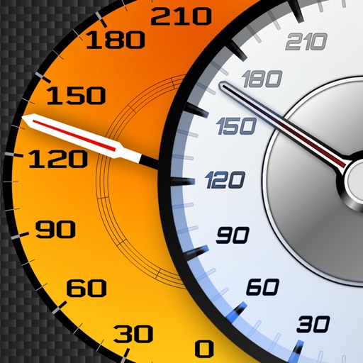
View supercar and engine
Track vehicle speed using GPS or simulation mode. View detailed speedometer displays with realistic graphics. Hear authentic engine during acceleration. Explore speed data from popular supercars.

Blue Whale Apps, Inc.
Track wind, waves, and surf conditions
View marine forecasts for U.S. coastal zones. Check wind speed, wave height, and surf conditions. Access one-touch NOAA forecasts for today, tonight, and the week. Add locations for custom alerts.

Applorium Ltd
Calculate from coordinates
Calculate using coordinates with options for square meters, feet, acres, hectares, kilometers, and miles. Measure distance between points. Premium users can save areas, add notes, attach images, and calculate prices based on values.

SERGEI BEZDENEZHNYKH
Save routes, create tracks, share locations, mark
Plan routes and save them for future use. Create and manage tracks with waypoints. Share routes with friends. Download maps for navigation. Mark locations and export tracks in GPX format. No ads and no time limits for use.

Zed Said Studio LLC
Track distance using GPS history.
The app tracks distance using GPS and saves it to history. It can export data to a .csv file for record keeping and works in the background.

Raul Martin Carbonell
Navigate with real-time traffic and alerts
Provide turn-by-turn GPS navigation with lane guidance and spoken instructions. Display limits and integrated detection. Automatically record routes, showing distance, time, , and cameras encountered.

IBN Software GmbH
Track speed and detect road signs
Tracks current speed and speed limits using -based road sign detection and OpenStreetMap data. Displays speed warnings in real time. Alerts users to zone 30, inner-city, and implicit speed limits. Shows speed and at a glance.

Delta T LLC
Set fan speed and brightness
Allows users to select from seven fan speeds and 16 LED brightness settings. Smart Mode automatically adjusts speed. Users can view current speed and light status. Schedules for speed and light settings can be created.

Stephen Fung
Track speed, view map, and monitor trips
View real-time speed with a precise digital . Access an on-screen heads up display for quick reference. See interactive maps with route navigation. Track trip details including distance, time, and average speed.
Apps are ranked by functional similarity, category fit, rating confidence, and popularity.