

151 votes - Navigation - First release: 2015-06-10T07:00:00Z
Screenshots


Description - 4+
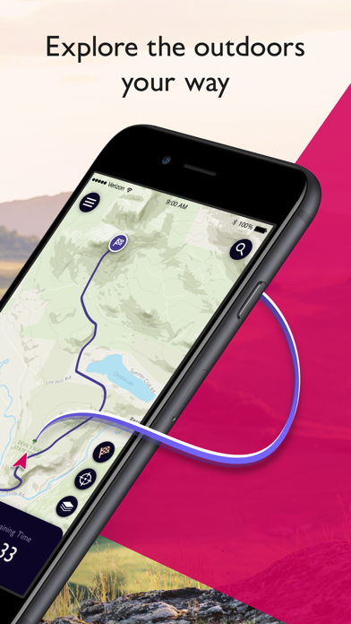
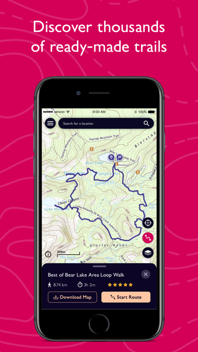
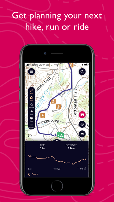
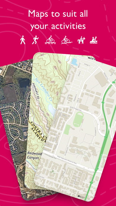
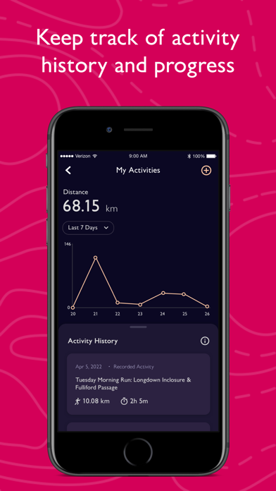
Explore the great outdoors the way you want, all while staying safe with OS Maps. Whether you want to hike, bike or run, OS Maps will guide you with amazing trails across the USA.
Want to find new places in your local neighbourhood? Or plan that next thru-hiking adventure? From breathtaking National Parks to easy walks along the coast, experience the thrill of finding a brand new trail that you never even knew existed with OS Maps.
Why you’ll love using OS Maps:
• EXPLORE NEW PLACES, CREATE NEW ADVENTURES
Plan unlimited trails with detailed, up to date maps across the country and discover that next great trail! Whether you love to hike, bike or run, there’s multiple map layers to suit any activity, including topographic and aerial maps.
• TRAILS AT YOUR FINGERTIPS
Search for the best trails in an area as rated by fellow outdoor enthusiasts and plot your own trail to follow, share and record.
• VIEW & DOWNLOAD MAPS OFFLINE
No cell reception? No problem. Download your favorite areas to save and view offline – so you can view your maps and routes even without cell reception. Plus, you can export your favourite trails & routes to your GPX device.
• TRAIL MAPS TO SUIT ANY ACTIVITY
Choose from multiple map layers; plan activities & find trails with detailed topographic mapping; or explore the landscape in stunning detail with aerial view. You can even see the world in 3D on desktop with 3D map layers.

• RECORD, REVIEW & RELIVE ACTIVITIES
Use the activity tracking feature, and activity history dashboard to track each & every adventure. Look back on past activities & review your stats.
• STAY SAFE ON THE TRAIL
Live GPS location tracking and never miss a turn with off-course alerts will keep you on track. Download trails, routes and maps and share with others.
• USE ON EVERY DEVICE
View, create and sync your activities between desktop and phone. On desktop, premium users can use our 3D aerial mapping to see detail on terrain, explore in stunning 3D and print maps.
• PLANNING MADE EASY
Use OS Maps as your off-road GPS tracker with automatic ‘snap-to-path’ making route planning easy with the shortest distance between your waypoints plotted automatically.
• UNLIMITED PRINTING
Print copies of trails and maps to take with you so you always have a backup to hand.
SUBSCRIPTION INFORMATION
$4.99 for monthly subscriptions and $28.99 for annual subscriptions
OS Maps offers an auto-renewing monthly subscription and an auto-renewing yearly subscription to provide you with premium access to OS Maps while you maintain an active subscription. If you choose to purchase a premium subscription, your payment will be processed by Apple.
Subscriptions may be managed by going to your Account Settings after purchase. Premium subscriptions automatically renew unless auto-renew is turned off at least 24-hours before the end of the current period. Your iTunes account will be charged for renewal within the 24-hours prior to the end of the current period. You may turn off auto-renewal after purchase by going to your iTunes Account Settings.
Terms and conditions: http://os.uk/termsosmaps
Privacy policy: http://os.uk/privacy
USEFUL INFORMATION
Battery life while using the app can be extended by downloading maps offline prior to use, operating in Flight Mode (the GPS will still work) and turning off the screen when not in use. We release updates to all of our apps as we improve them, making them even more stable and adding extra features. Along the way, your feedback and comments about this app are really important to us. If there’s an issue or something you’d like us to know, head to https://www.ordnancesurvey.co.uk/contact-us
*This feature uses Apple's ARKit which requires an iPhone 6s, iPhone SE, iPad 2017, iPad Pro or any later device.