

355 votes - Navigation - First release: 2014-07-13T04:45:18Z
Screenshots


Description - 4+
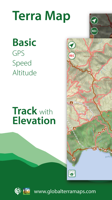
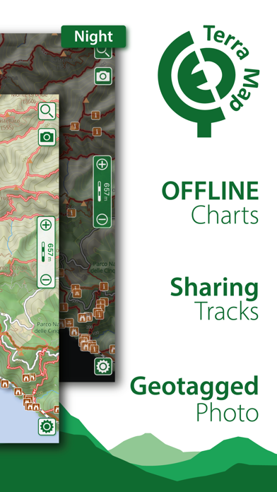
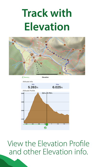
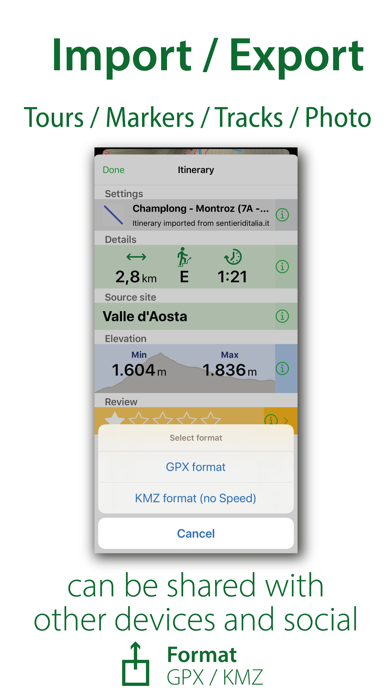
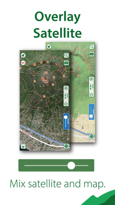
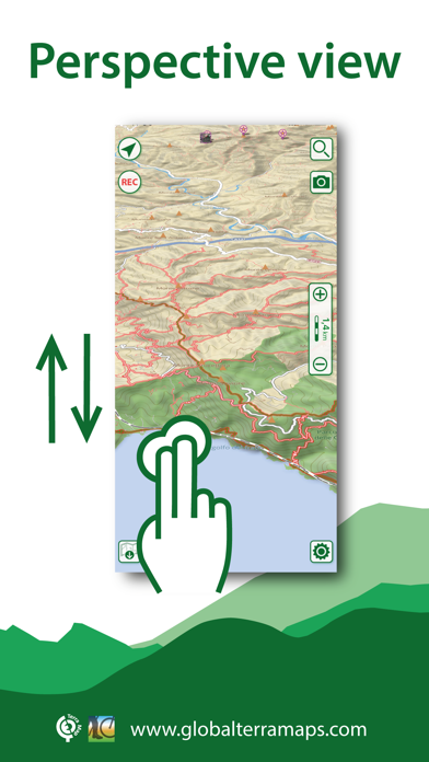
An app to satisfy all your Hiking and Biking’s needs, developed with the help of professional hikers and bikers. You will be able to download the best topo maps and enjoy your new outdoor season. Press the RECORD button, put the phone in your pocket and record your day.

►► Features:
• Optimised for both iPhone and iPad use.
• Amazingly clear maps, thanks to the Retina technology usage.
• Easy to use user interface.
• You can download maps (for FREE) on the device, to be used later without any internet connection.
• Topo Maps for US, Canada, Europe, South America, Asia, Africa, Oceania (the whole world !!!).
• Share tracks, tours, markers and photos in various formats (KMZ, KML, GPX).
• Share your track together with all the photo taken along in one single file.
• Add the Satellite images as overlay of your map.
• Optimized battery usage with battery monitoring.
• Store your track without the need of cellular data or phone signal.
• Switch between different map colouring.
• Customize your Marker's icon and Track's color.
• Measure distances on the map.
• Load any track, tour and marker from internet communities (KMZ, KML, GPX even if zipped)
• Graph of the elevation profile and speed for each track.
• Search world places by name

► MAPS
Terra Map lets you download — for FREE !!! — the best topo maps with elevation contours, trails, huts, parks, etc. and no additional purchase is required. You can download the maps at home within your device and then use them without any Internet connection need. Check our maps at: www.globalterramaps.com/terraviewer.html

► SHARING
Why not sharing your favorite markers on Facebook or sending an email with your last daily track, with all the pictures you captured (Note 1) to show them on Google Earth™ or Maps ? With Terra Map it is just a click.

► ELEVATION ANS SPEED GRAPHS
Record all important info of your track and plot the graph of elevation and the graph of the speed.

► iOS BACKGROUND MODE
You can record GPS track while Terra Map is in background and while the device is locked.

► TYPE OF PURCHASES
- Unlimited: you can download and update your charts forever.
- Subscription: it is an year auto-renewable subscription, it will automatically renews unless auto-renew is turned off at least 24-hours before the end of the current period. Account will be charged for renewal within 24-hours prior to the end of the current period. Subscriptions may be managed by the user and auto-renewal may be turned off by going to the user's Account Settings after purchase.
Payment will be charged to iTunes Account at confirmation of purchase

Terms of Service: http://www.globalaquamaps.com/Acknowledge.html
Privacy Policy: http://www.gec-it.com/GEC-privacy.pdf

————

Note 1. Pictures captured by Terra Map while recording the track are automatically linked to the track itself, and sent with the track when you share it.

Note 2. The effective battery duration depends by the battery condition, by the temperature and the device usage.