
Fire Finder - Wildfire Info
Find locations on a map
Scott Martin
iPhone Screenshots

Description
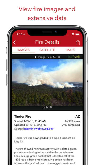
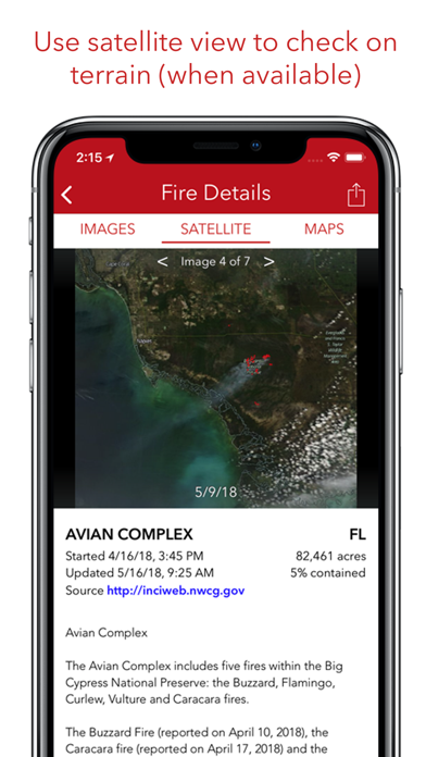
View locations and perimeters on interactive maps with satellite imagery. Access a photo gallery of fires. Share images and details with contacts. Retrieve information from state and federal sources.
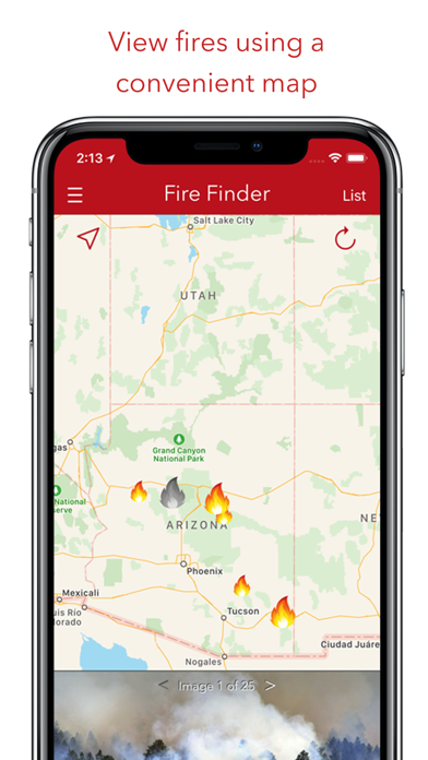
Fire Finder is your best source for finding information and images of wildfires in the United States. Display fire data on a convenient map with satellite imagery or choose from a list of fires. Easily share fire images and information with friends and loved ones.
Features:
- Maps wildfire locations and fire perimeter data (where available)
- Photo gallery of fires (where available)
- Display fire information from state and federal sources including: inciweb.org, fire.ca.gov, U.S. Forest Service and more
- Map active fire perimeters from geomac.gov
App information from Apple App Store. Fire Finder - Wildfire Info and related trademarks belong to Scott Martin.