
NaviMaps: 3D GPS Navigation
Navigate with 3D GPS and voice directions
CE Info Systems Limited
iPhone Screenshots
iPad Screenshots


Description
Provide turn-by-turn with 3D maps and voice directions. Access detailed maps for India, Bangladesh, Bhutan, Nepal, and Sri Lanka. Save mobile data by functioning offline. Use live traffic updates when connected to the internet.
Never miss a turn with NaviMaps: 3D GPS Navigation. MapmyIndia now brings the most accurate car navigation system trusted by Maruti Suzuki, Jaguar Land Rover, Toyota, Fiat & Mahindra to your device.
NaviMaps: 3D GPS Navigation, an interactive maps and navigation app with voice direction. Get detailed maps of India, Bangladesh, Bhutan, Nepal & Sri Lanka, powered by MapmyIndia. Save your mobile data as NaviMaps: 3D GPS Navigation doesn't require internet to function. With internet, get Live Traffic feed, Location & Route sharing via SMS, WhatsApp, Email & Facebook.
INSTALL NaviMaps: 3D GPS Navigation today to get access to all Pro-Guidance features for FREE for 7 Days.
Features Include:-
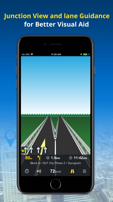
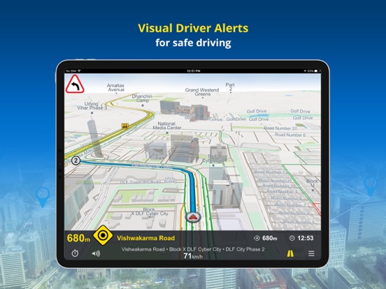
• Junction Views - Visual aid to the driver at road junctions.
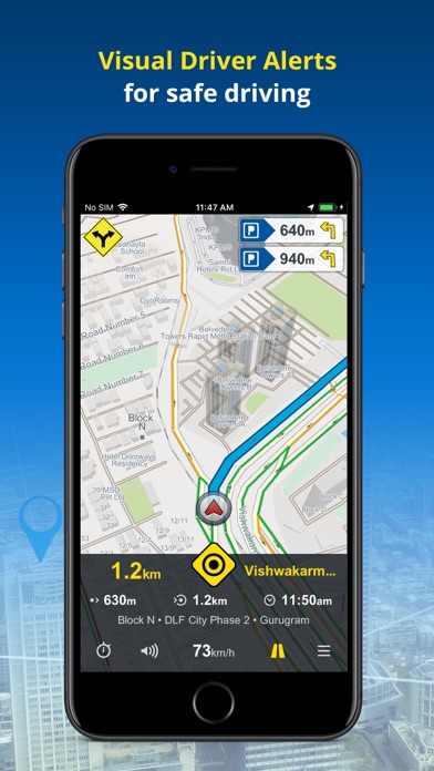
• Driver Alerts & Realistic Signposts - Visual driver alerts for better situational awareness.
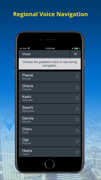
• Live Turn-by-Turn voice guidance in English & 10 regional languages: Hindi, Kannada, Marathi, Punjabi, Bengali, Gujarati, Malayalam, Oriya, Tamil & Telugu*
• Text to Speech - NaviMaps speaks out place names during voice prompts.
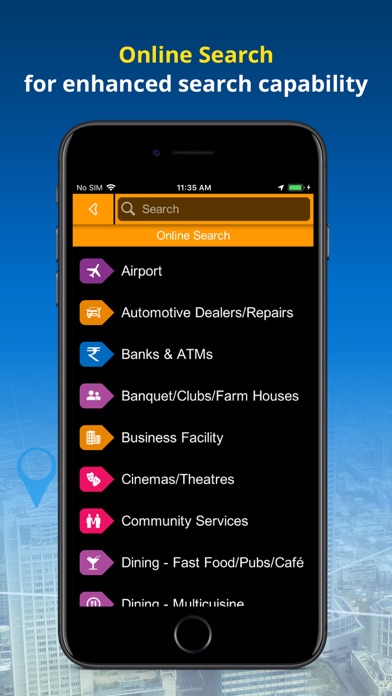
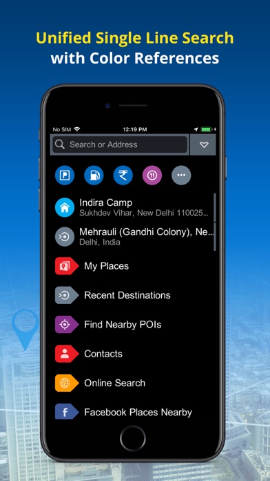
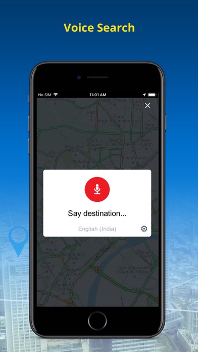
• Unified Search: Search EVERYTHING from one interface with colour coded visual references.
• Auto re-route navigation with voice will re-route you from the deviated course.*
• Varied POI, down to the house no., also locate Petrol Pumps & Parking Places along the route.*
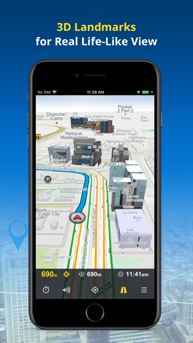
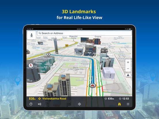
• Detailed map coverage, realistic 3D Landmark, terrain & city models for better recognition*
• FREE lifetime MAP UPDATES*
• NaviMaps: 3D GPS Navigation can be synced with your in-car navigation system, making it into a fully-featured navigation system. NaviMaps supports connectivity with Maruti Suzuki Smartplay Studio™ Infotainment*
• Offline maps, directions, local search and Online search on your device
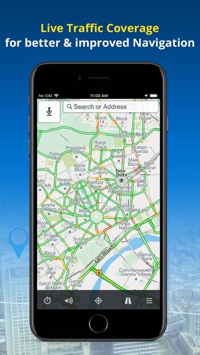
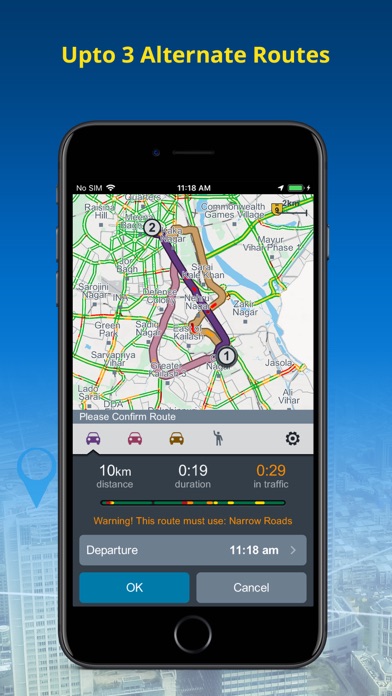
• Get up to 3 alternate driving routes & 1 pedestrian route. The route automatically updates you with Live Traffic (Internet required)
• Location & route sharing through WhatsApp, SMS, Email & Facebook
• Via internet, get live traffic & expected delay.
• Multi-Stop routing to plan trips for leisure or business
• Multi-touch map display
• Two-finger swipe down to return to map view from any page or menu
Maps:-
Map of India is split into 32 different states which you can download as per travel plan. Download, remove & re-download maps as often as they like.
• 6.54 Million+ kms of roads connecting 7850+ towns & 12 lakh+ villages
• 40 Million+ Points of interest across the Country
• 6500+ 3D Landmarks & 2D footprints in 950+ Cities
• 15.5 Million+ house numbers for last mile navigation in 700+ cities
• Lane Guidance in 1778+ cities along with national stretches
Sri Lanka:
• 135K+ kms of roads connecting 145 cities at street level with 42.4K+ towns & villages
• 270K+ Points of Interest
• 94 3D Landmarks & 2220000K+ 2D footprints in 8 Cities
• Lane Guidance in 53 cities
Nepal:
• 182K+ kms of roads connecting 290 Cities at street level with 41.8K+ towns & villages
• 218K+ Points of Interest
Bangladesh:
• 180K+ kms of roads connecting 290 Cities at street level with 45K+ towns & villages
• 351K+ Points of Interest
• 8.9Mn+ 2D footprints
Bhutan:
• 17800+ kms of roads connecting 27 Cities at street level with 700+ towns & villages
• 7000+ Points of Interest
Install NaviMaps: 3D GPS Navigation today.
Note:
Continued use of ANY GPS application running in the background can significantly drain your phone’s battery. Using a charger while navigating is recommended.
* Requires purchase of Pro-Guidance in-app.
For any app related issues and feedback, please mail us on (mailto:[email protected]). We would love to hear from you.
App information from Apple App Store. NaviMaps: 3D GPS Navigation and related trademarks belong to CE Info Systems Limited.