

55014 votes - Sports - First release: 2013-12-19T01:01:01Z
Screenshots
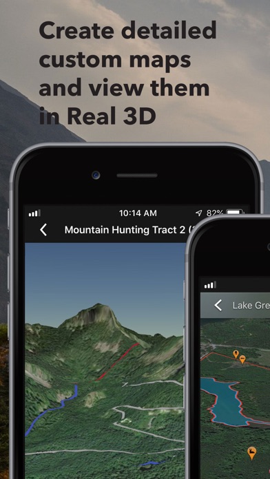
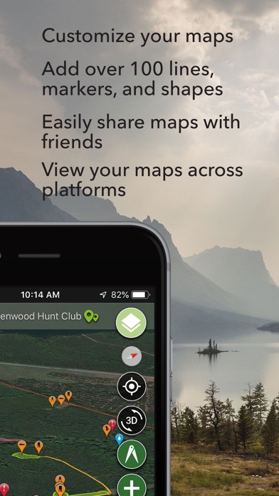
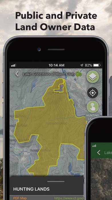
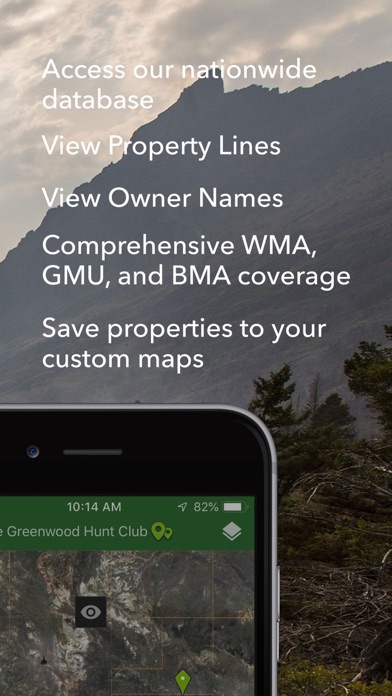


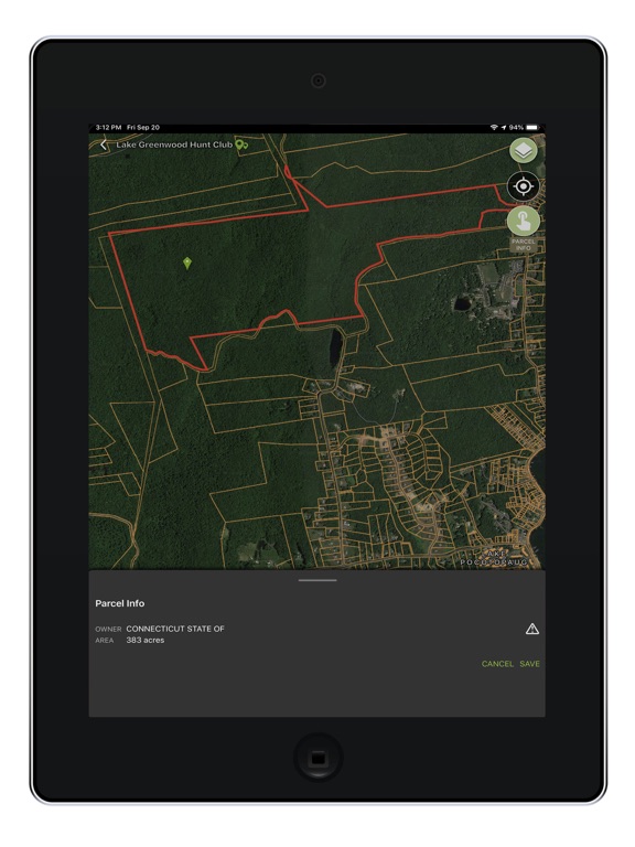
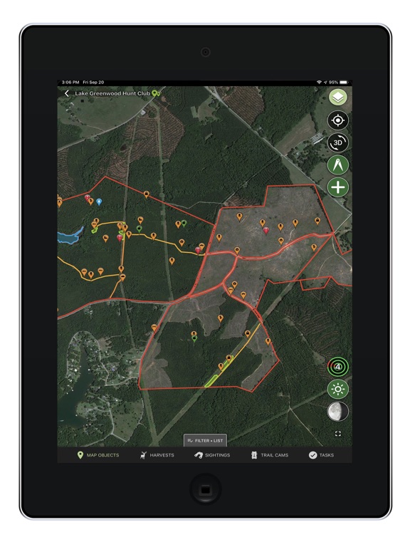
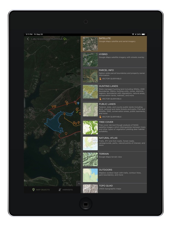


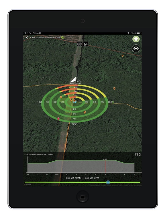
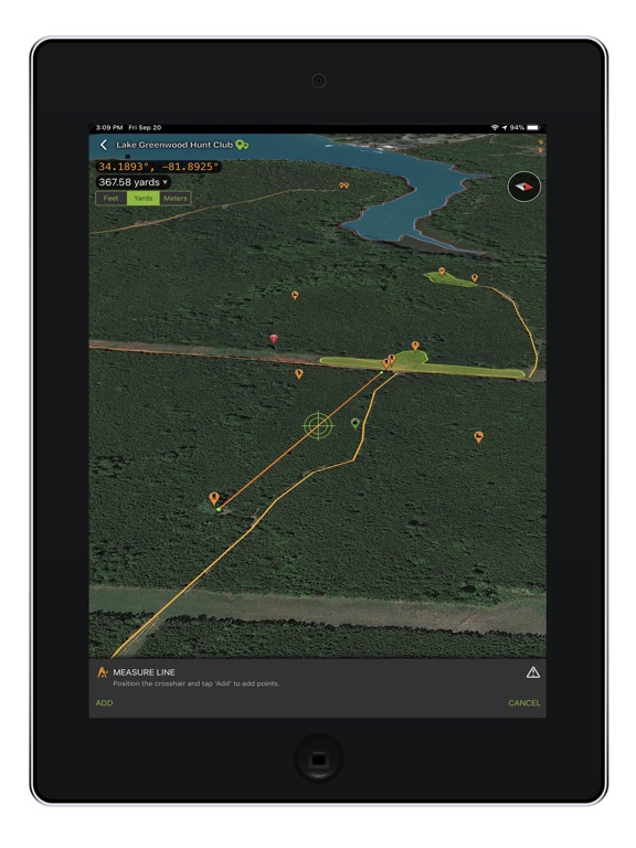

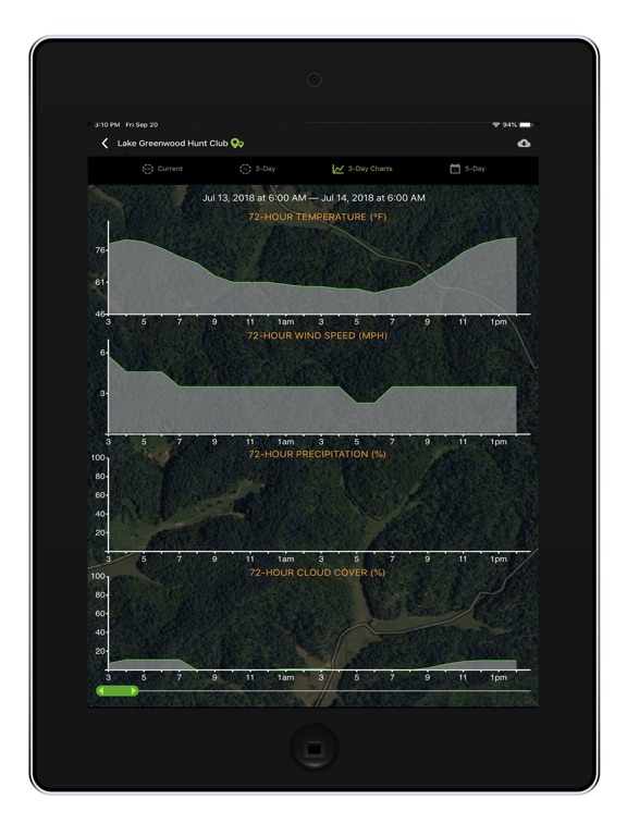
Description - 4+
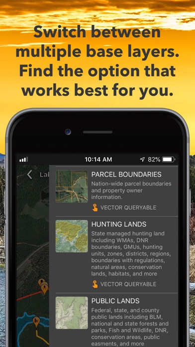
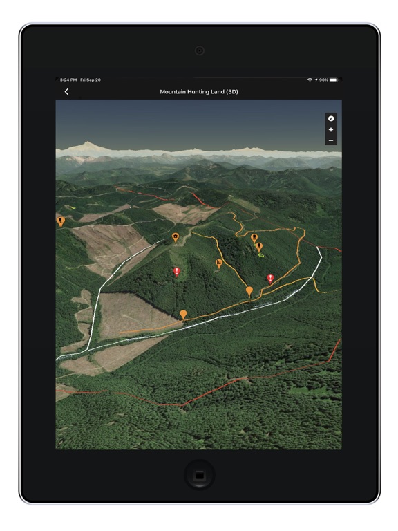
Outdoor Life Magazine Editors’ Choice for Best Hunting App. Featured in multiple publications as an invaluable tool.

HuntStand, with millions of downloads, is the #1 hunting app in the world and is the only hunting- and land-management app you will ever need. This revolutionary app is packed with invaluable mapping, weather, tracking, and social features.

Using this app, you will have access to offline weather and maps of your hunt areas. You can edit your maps while out “in the field” then sync them with your HuntStand account to further explore them online.

Gain access to nationwide property boundary and owner information, our proprietary Hunting Land layer, 3 different satellite image layers, and many other useful interactive maps.

View relevant written and video content from HuntStand Media including gear reviews, hunting tactics, useful tips, and much more.

Use our Harvest, Sightings, and Task logging features to understand your property like never before.

Upload your trail camera photos to HuntStand.com to see incredible game movement insights and sync them to the HuntStand app.

Fully map your property using more than 100 easily-discernible custom icons, shapes, and lines including scouting marks, stands, property boundaries, food plots, ponds, roads, trails, and numerous other important objects of interest.

View distance and area measurements using our advanced measurement tools. Our app will give you extremely accurate map-based distances in feet, meters, and yards and area measurements in acres.


Create an account and gain the ability to:

• Sync Hunting Area maps with HuntStand.com

• Order ultra-high-resolution printed maps through the HuntStand.com website that you create using the HuntStand app.

• View and edit maps using ultra-advanced online mapping features

• Share maps with friends

• Create a personal profile

• Add friends to your network

• Locate your friends using the Friend Finder feature

• Join group hunting areas (allowing you to share and edit maps with your hunting friends)

• View advanced statistics built from your personal harvest and sighting history


In-app purchases are available to remove advertising for one year and also for HuntStand Pro.


HuntStand Pro includes:

• The removal of all advertisements

• Unlimited property parcel queries across the country. View property boundaries, size, and owner names. Add property boundaries to your custom maps.

• The ability to view your maps using our true 3D technology

• Hunting Lands: State managed hunting land including WMAs, DNR boundaries, GMUs, hunting units, zones, districts, regions, boundaries with regulations, natural areas, conservation lands, habitats, and more

• Public Lands: Federal, state, and county public lands including BLM, national and state forests and parks, Fish and Wildlife, DNR, conservation areas, public easements, and more

• Tree Cover: Tree cover derived though analysis of NASA satellite imagery

• Natural Atlas: Trails, ATV and 4x4 roads, forest roads, campgrounds, parks, natural points of interest, and more

• DG Vivid: Digital Globe Satellite Imagery with vivid colors

• Mapbox Satellite: Advanced Mapbox Satellite Imagery

Payment will be charged to your iTunes Account at confirmation of purchase;

Subscription automatically renews unless auto-renew is turned off at least 24-hours before the end of the current period;

Your account will be charged for renewal within 24-hours prior to the end of the current period, and identify the cost of the renewal;

You can manage subscriptions and turn auto-renewal off by going to your Account Settings after purchase; and

Any unused portion of a free trial period, if offered, will be forfeited when the you purchase a paid subscription.

Please read our privacy policy (https://huntstand.com/privacy) and terms & conditions (https://huntstand.com/terms-and-conditions).