
myGIS Manager
Manage and share organizational maps securely
Butler Fairman and Seufert Inc.
iPhone Screenshots


iPad Screenshots


Description
Access and manage organizational data securely from any location. Edit and view web maps for internal use or public transparency. Integrate with custom applications or larger software packages for tailored solutions.
myGIS Manager is a cloud based organization mapping system, offering organizational security and administration. It provides editable web maps for internal organizational uses but also opens for public transparency if needed. We can provide interaction with custom applications or work with larger software packages to provide solutions that work for your organization.
Features:
Access your data anywhere - whether is outside or in the office, access to your data is a few clicks away.
Keep your maps private and determine who has access to them without subscription fees or create public maps for use by everyone.
Show your GPS location on map in real-time.
Change between different base maps with ease.
Visual reference to all map features and adjust the visibility of layers with one-touch.
Easily identify any available attribute data.
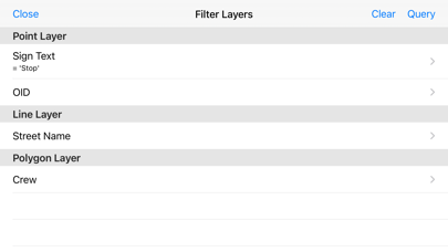
Quickly search attribute data and zoom to feature.
Turn mobile devices into data collection devices with the ability to add or edit data in a few clicks.
Ability to link features to additional 3rd party data sources.
App information from Apple App Store. myGIS Manager and related trademarks belong to Butler Fairman and Seufert Inc..