iPhone Screenshots


iPad Screenshots


Description
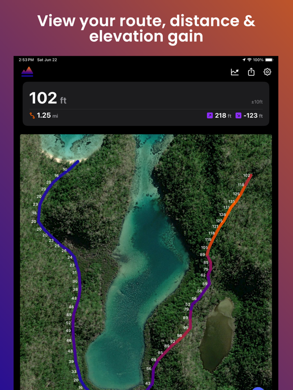
Elevation Tracker allows you to track your altitude in real-time and visualize the elevation along your route.
Altitude measurements are obtained from your phone's internal GPS sensor, offering optimal accuracy outdoors and in open areas.
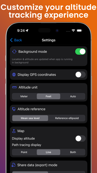
Features include:
- Live altitude display
- Altitude tracking on a map in satellite, hybrid, or normal mode
- Choice of measurement units between meters and feet
- Selection of altitude reference
- Real-time display of GPS coordinates
- Ability to share & export your location and altitude data
- Customization of your route display according to your preferences
The app works perfectly without an internet connection.
Download Elevation Tracker today to keep control of your altitude and route!
App information from Apple App Store. Elevation Tracker: Altitude and related trademarks belong to Florian Delaunay.