
iPhone Screenshots
iPad Screenshots


Description
Navigate public transport with real-time updates and planning. View interactive maps for easy panning and zooming. Find stops, schedules, and transfers. Get directions to specific locations like Speicherstadt or Blankenese.
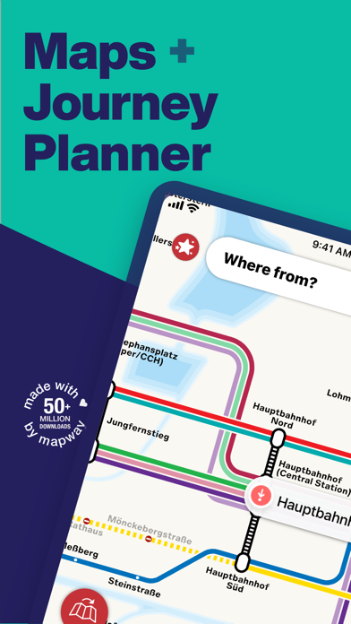
Hamburg Metro is the navigation app that makes travelling by HVV transit in Hamburg simple
From the Speicherstadt to the Treppenviertel Blankenese, cheering on Hamburg SV or rooting for FC St. Pauli, whether you’re a Hamburg native on your commute to work or sightseeing fresh from Hamburg Airport we’ll show you the best way to get where you’re going in Hamburg. We make taking the U-Bahn easy.
Tap, tap, tap!
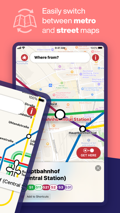
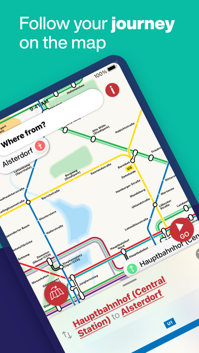
Pan and zoom your way across Hamburg with ease using our simple, interactive maps. We’ll even show your route on the map
Plan journeys, sharpish
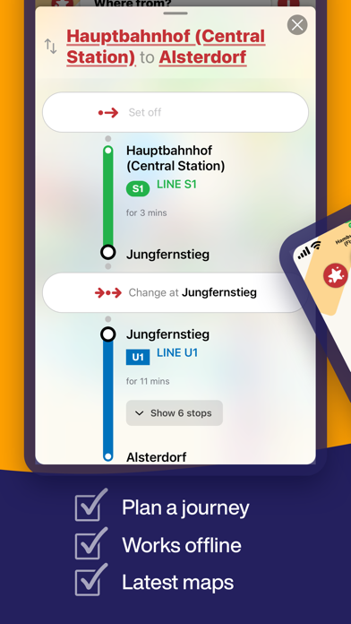
Search for stations and find your way using the world’s fastest route planner
No internet? No problem
Maps and journey planning even work offline
Regular map updates
Auto-magic updates keep our maps always up-to-date and box fresh
Every step of the way
Step-by-step guide means you’ll never get lost again
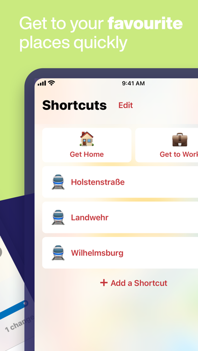
Save your faves
From finding your way back home, to taking the stress out of commuting, and all the places in-between. Your personal Shortcuts are never more than a swipe away
Hamburg Metro Plus features:
An ad-free experience
Proper VIP treatment, with no ads, ever
Priority support
Problem with the app? We’ll be there to help you out
We’re the world's number one for transit apps, check out our world-famous Tube Map London, New York Subway Map and Paris Metro Map apps today
Visiting Berlin, Munich or Barcelona soon? We’ve got you covered there too. Take our apps with you, just search Mapway on App Store
Hamburg Metro Plus available as an in-app subscription: 2,49 € monthly or 5,49 € annually, or as a one-off purchase of 12,99 €. Prices may vary by location. Cancel at any time, for any reason. Payment will be charged to your iTunes Account at confirmation of purchase. Subscription automatically renews unless auto-renew is turned off at least 24-hours before the end of the current period. Your account will be charged for renewal within 24-hours prior to the end of the current period, at the cost of your chosen price tier. Subscriptions can be managed and auto-renewal may be turned off by going to Account Settings in your iTunes Account. Any unused portion of a free trial period, if offered, will be forfeited when a subscription to that publication is purchased, where applicable. Read our terms in full at mapway.com/terms
App information from Apple App Store. Hamburg Metro - Map & Route and related trademarks belong to Mapway Limited.