
Avenza Maps: Offline Mapping
Navigate with maps and GPS
Avenza Systems Inc.
iPhone Screenshots
iPad Screenshots


Description
Use GPS to navigate trails . Import custom maps and create personal maps. Access topographic, hiking, cycling, and city maps from publishers like National Geographic and National Park Service. Sync with devices for use.
Avenza Maps, #1 app for hiking, biking and all trails. Featuring maps from National Geographic, national parks and more!
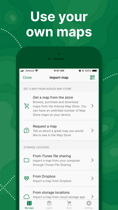
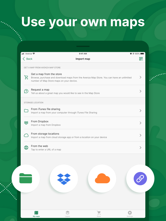
On your next adventure, stay on track with GPS using offline mobile maps. Make your own maps? Import your custom maps and never get lost off the grid.
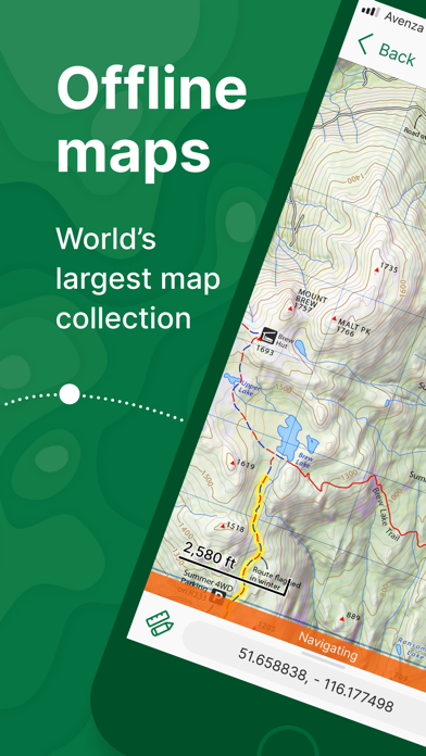
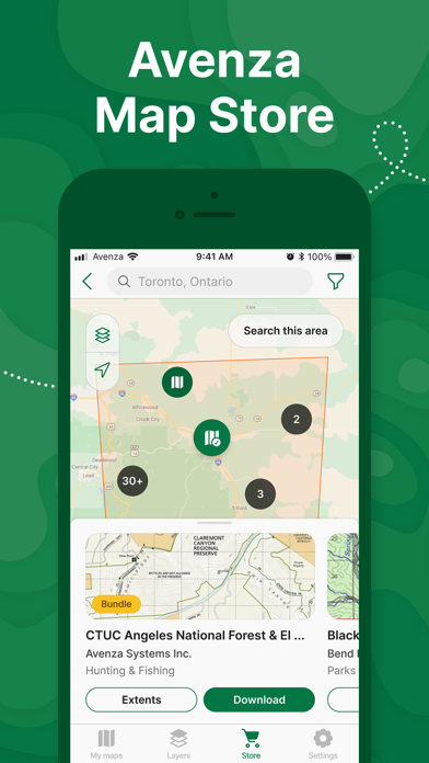
Explore the largest mobile Map Store of hiking, topographic, cycling, city, nautical, travel, and trail maps. Featuring maps from professional publishers including National Geographic, National Park Service, and the US Forest Service. Discover maps for your next camping, fishing, or backpacking trip with your family and friends. Navigate confidently when off-roading or taking those backcountry trails. Precisely identify your location with what3words and stay safe wherever you are.
Avenza Maps is free and the best map app for recreational use. Maps are available for free or purchase from the in-app Map Store. Plus subscription is available for unlimited custom map imports. Pro subscription is available for professional users with full access to all features and mapping tools.
Avenza Maps for your offline adventures on all trails!
ENHANCE YOUR MAPS WITH THESE FEATURES
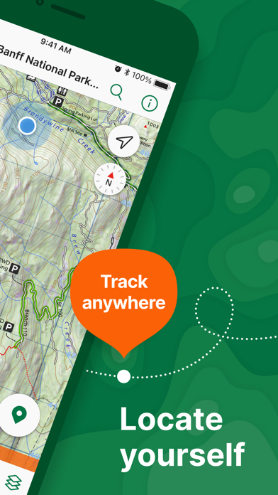
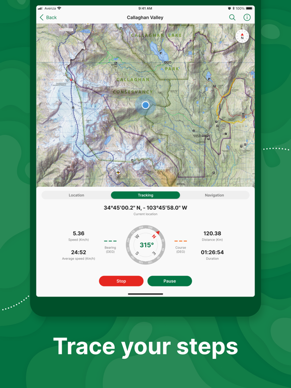
- Locate your realtime GPS position and find direction, even when offline
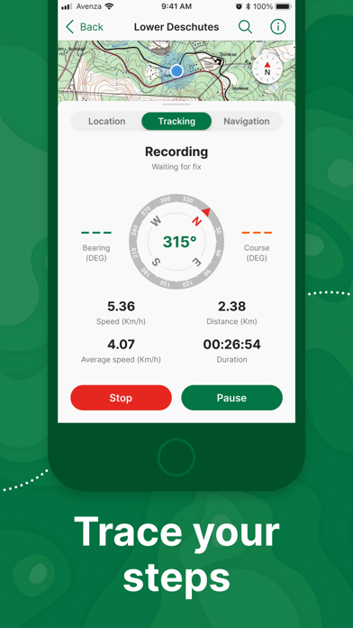
- Record GPS tracks during your activities
- Navigate to features using compass tools
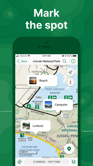
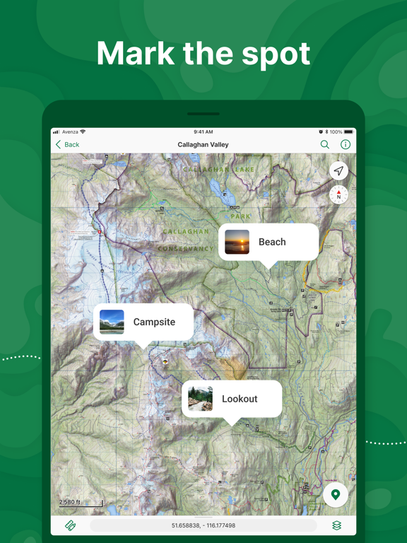
- Add photos and notes to any location
- Add placemarks to your map and style them with recreational symbols
- Measure distances and estimate times
- Supports KML, GPX, and CSV Formats
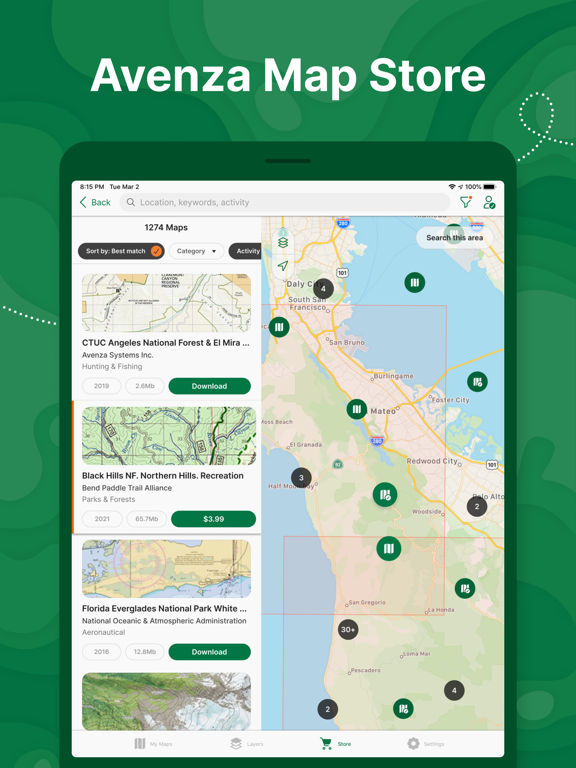
EXPLORE THE MAP STORE
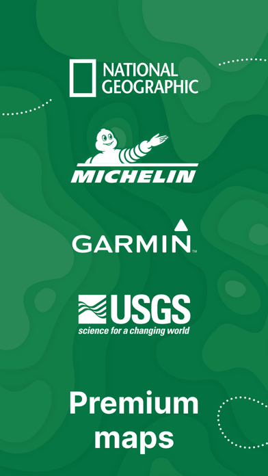
Search and download maps by activity, category, and specific publishers with premium maps from:
- National Geographic
- Michelin
- Backroad Mapbooks (BRMB)
- New York - New Jersey Trail Conference
- USFS (United States Forest Service)
- USGS (United States Geological Survey)
- FAA (Federal Aviation Administration)
- NOAA (National Oceanic and Atmospheric Administration)
- BLM (Bureau of Land Management)
- HarperCollins
- DeLorme Atlas & Gazetteer / Garmin
- BaseImage
- National Park Service
- And thousands more!
A free account lets you access all of your map downloads.
GET MORE WITH AVENZA MAPS PLUS
For recreational and power users who need more
- Unlimited import of your own geospatial PDF, GeoPDF®, and GeoTIFF maps
- Create geofences for up to 50 individual features and up to four geofence layers
GET EVEN MORE WITH AVENZA MAPS PRO
For professionals and organizations who require an offline mapping solution with location awareness with more features and tools
- Unlimited import of your own geospatial PDF, GeoPDF®, and GeoTIFF maps
- GPS averaging, additional coordinate display formats, custom symbol sets
- Connect high-accuracy GPS devices including Trimble, Bad Elf, and Dual via Bluetooth
- Created unlimited geofences and get global geofence notifications
- Convert tracks to areas
- Map orientation lock
- Import and export Esri® Shapefiles
- Import and manage custom symbology sets
- Priority technical support
Avenza Maps Pro subscription required for commercial, academic, government, and professional use.
Avenza Maps Plus and Pro are available as annual subscriptions. You can subscribe and pay through your Apple ID. Subscriptions are 12 months in duration and will automatically renew unless auto-renew is turned off at least 24 hours before the end of the current period. Your account will be charged within 24 hours prior to the end of the current period at the rate of your selected plan. Auto-renewal can be turned off in your iTunes Account Settings. If you didn’t use iTunes to subscribe, you can manage your subscription through Avenza.
SUPPORT
We can help! Go to support.avenzamaps.com
LEGAL
Privacy Policy: avenzamaps.com/legal/privacy-policy.html
Terms of Use: avenzamaps.com/legal/terms.html
CONNECT WITH US
avenzamaps.com
facebook.com/avenzamaps
twitter.com/avenzamaps
instagram.com/avenzamaps
App information from Apple App Store. Avenza Maps: Offline Mapping and related trademarks belong to Avenza Systems Inc..