
iPhone Screenshots


iPad Screenshots


Description
A land navigation GPS and offline map app built for iOS. No ads. Privacy respected.
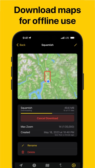
Land Nav will help you navigate the outdoors providing you with a GPS, compass, 3D topographic and satellite maps. Place a marker on the map and get a bearing to that location in seconds. Import GPX waypoints and tracks into a task specific map documents that are synced using iCloud to all your devices. Downloadable maps allow use while offline.
## Main Features
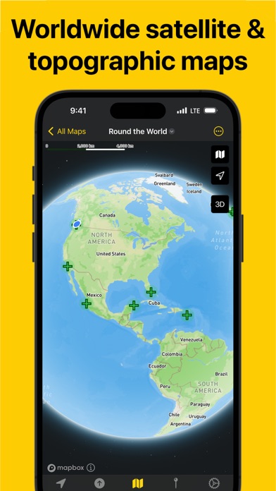
- Worldwide 3D topographic and satellite maps powered by Open Street map
- Download maps for online use
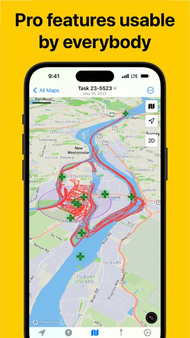
- Organize tracks and markers in task based documents
- Designed from the ground for iOS using the latest Apple technologies
- Universal app supports iPhone and iPad with macOS coming soon.
## Additional Features
- Compass with inclinometer
- Show sunset & sunrise times, moon phase, and magnetic declination
- GPX import/export for waypoints, tracks, and routes
- Customizable coordinate formats and units including UTM, MGRS and Mils
- Document interface to organize map data
- Universal app works on iOS and iPad (macOS comming soon)
- iCloud sync, plan on your iPad, navigate on your phone
- No ads and no tracking
- Generous free trial, no subscription, single in-app purchase to buy
- Support independent app developer with a passion for the outdoors
App information from Apple App Store. Land Nav and related trademarks belong to Gerry Shaw.