
Transconomy Collector
Split data, assign areas, collect images
iENGINEERING Corporation
iPhone Screenshots


Description
Navigation allows transportation agencies to divide project data into specific areas for image collection. Assign areas to data collectors who can view them on a map. Collectors capture images at specified spatial or temporal intervals.
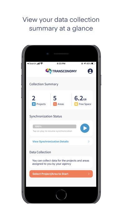
Transconomy lets state and local transportation agencies to conveniently split network-level project data into manageable areas for image data collection.
Allocate the areas to your collectors (data collection drivers) who can use the Transconomy Collector app to collect data in assigned areas. Specify a spatial or temporal frequency for image capturing. Your data collectors can use the app to visualize the areas assigned to them on a map for collection. While the collectors drive through the area, Transconomy Collector captures roadway images and uploads directly to the cloud-based Transconomy Hub on the go. You can choose to use cellular data to sync as you drive or use a wireless network to sync after collection.
App information from Apple App Store. Transconomy Collector and related trademarks belong to iENGINEERING Corporation.