
Smoke Point
Track wildfires with live camera feeds
Gabriel Schine
iPhone Screenshots


iPad Screenshots


Description
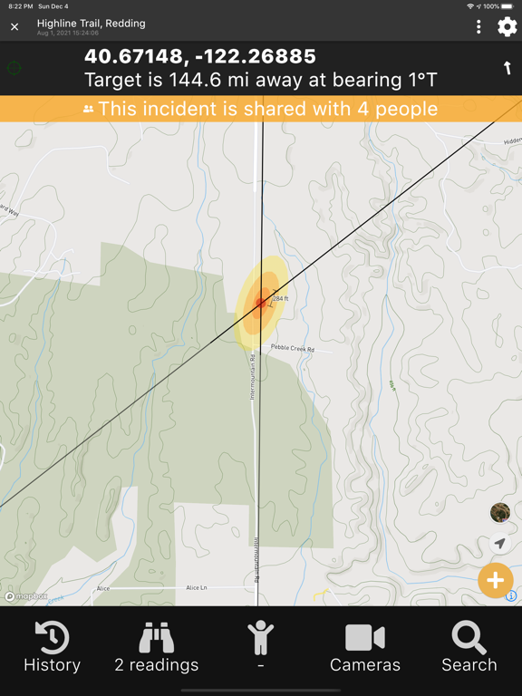
Locate wildfires using camera networks, phone camera, and user reports. View live images from over 800 cameras. Determine fire position and direction. Triangulate location with uncertainty bounds. Share observations with others.
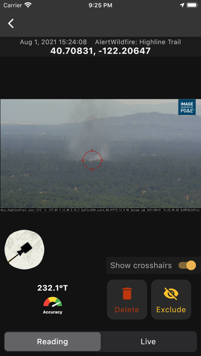
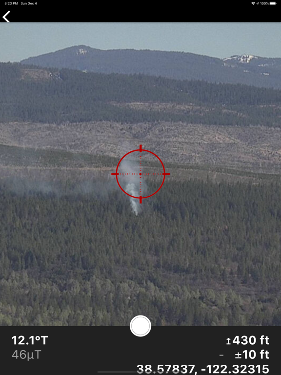
Quickly locate the positions of new wild fires through the ALERTCalifornia and Alert Wildfire camera networks, your phone's camera, and crowd-sourced observations from nearby users.
* Access information and live images from 800+ (and growing) ALERTCalifornia (http://alertca.live/) and Alert Wildfire (http://www.alertwildfire.org/) camera images
* Acquire position and directional observations directly from your mobile device
* Triangulate fire position with uncertainty bounds
* Utilize your own observations as well as those shared by users nearby
* Receive push notifications for new nearby observations
Help firefighters and local citizens gain situational awareness in the early stages of new wildfires, when accurate and actionable information is scarce.
Smoke Point is an app used by firefighters and the public to provide location information about new fires in the wildland. Smoke Point is purpose-built for triangulation of fire position using ALERTCalifornia and Alert Wildfire cameras and the phone's built-in camera.
App information from Apple App Store. Smoke Point and related trademarks belong to Gabriel Schine.