

2 votes - Business - First release: 2020-09-22T07:00:00Z
Screenshots


Description - 4+
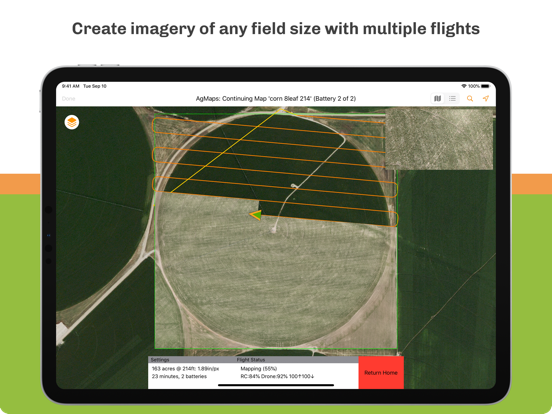
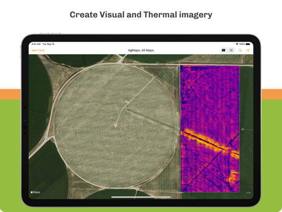
Create aerial imagery of your crops using a drone. Simply create a flight plan, connect your drone, and AgMaps will control the drone and create imagery while the drone is in flight. Drop pins on locations in your field and AgMaps will fly the drone out to each location and take a close up photo.

- Supports DJI Mavic 2 Zoom, DJI Mavic 2 Enterprise Dual, and DJI Mavic 2 Pro drones.
- Create visual, thermal, and Plant Health imagery.
- Export imagery for easy sharing via email.
- Create scout reports with overview and PinPoint close-ups.
- High gain antennas are recommended for larger fields.
- Terrain data for high-quality aerial imagery is available in the continental United States.

iPad Pro (2018 or later), iPad Mini (2019 or later), iPad (2020 or later), or iPad Air (2020 or later) recommended for best performance.