
Pilot's Airport Reference Lite
Filter frequencies by state or type
George Smorse
iPhone Screenshots


Description
Tool provides communication frequencies and runway details for major U.S., Hawaii, and Alaska airports. Filter by state or type. Search by name or IDENT code. View runway configurations and approach information.
The Pilot’s Airport Reference Lite Edition is a comprehensive collection of communications frequencies and runway configurations for large airports based in the continental United States, Hawaii and Alaska.
The list can be filtered by state and/or airport type or browsed in its entirety. Scroll to the top of the list to reveal the search bar.
Use the search bar to quickly find an airport by entering any part of its name (Los Ange) or IDENT (LAX).
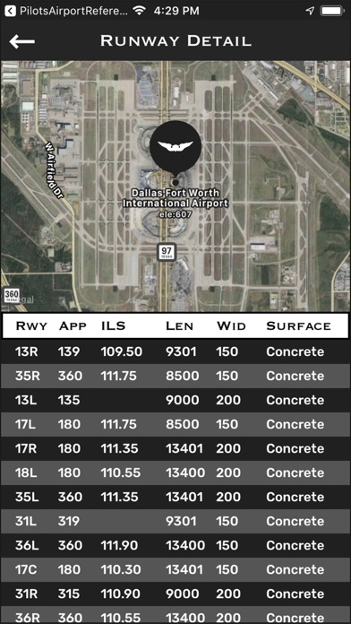
The runway information view includes approach headings and, where available, Instrument Landing System (ILS) frequencies. This view includes an overhead satellite view of the air field.
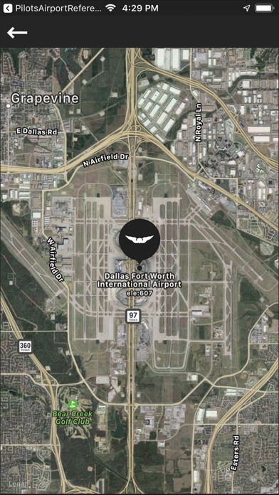
Touching the ‘Closest Airport’ button retrieves the closest airport to the user’s current location. In this mode, heading and distance information is displayed with each airport and the satellite view is zoomed out to show both the airport and user locations.
App information from Apple App Store. Pilot's Airport Reference Lite and related trademarks belong to George Smorse.