
OpenSky - App for Drone Flyers
Plan flights with airspace rules
Wing Aviation LLC
iPhone Screenshots


iPad Screenshots


Description
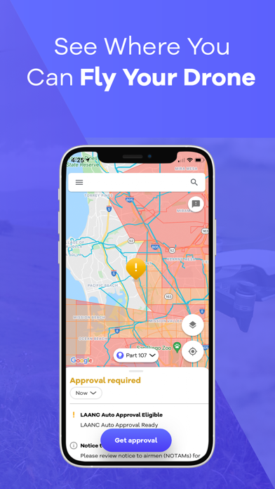
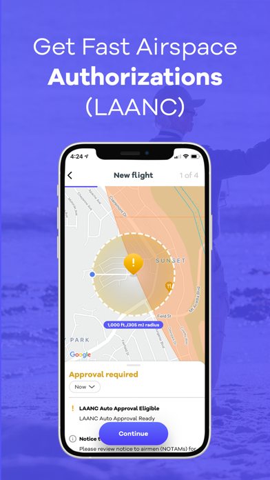
Check flight rules and airspace restrictions in the U.S. and Australia. View compliance maps from aviation authorities. Plan flights using Google Maps. Access controlled airspace with LAANC. Set flight locations and receive real-time updates.
Knowing where it’s legal to fly your drone can be complex. OpenSky is the simplest and fastest way to view drone rules and regulations in the U.S. and Australia. Powered by Google Maps, pilots can find out where to fly their drone, plan a flight with a few quick clicks, check airspace rules and get automated access to controlled airspace (LAANC).
Features of OpenSky include:
Guide for drone flying - Find out where and when you can and cannot fly.
Compliance maps from Aviation Authorities - OpenSky makes it easy to visualize airspace rules tailored to your operation and aircraft; for both commercial & recreational drone operators.
Identify Risks - OpenSky will help identify possible flight hazards in your area like Temporary Flight Restrictions (TFRs).
Airspace authorizations - Drone operators can automatically request authorization to fly in controlled airspace, often the busy airspace near major cities. In the United States this is called LAANC.
Track your missions - OpenSky will track and manage your past and upcoming flights, notify you of changes to any planned flights.
You can find out more about OpenSky at: www.wing.com/opensky.
App information from Apple App Store. OpenSky - App for Drone Flyers and related trademarks belong to Wing Aviation LLC.