
iPhone Screenshots
Description
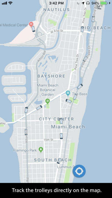
View trolley locations on a map and check nearby . Tap a trolley to see its route name and animation. Track trolley movements and explore the network of free available to all users.
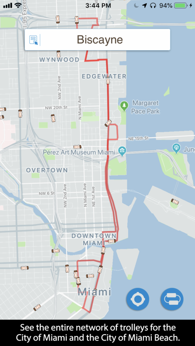
The trolleys are displayed on a map where you can easily and intuitively determine what trolleys are nearest to you. Use this app to familiarize yourself with the vast network of free trolleys available for free to everyone. You will be surprised how many there are!
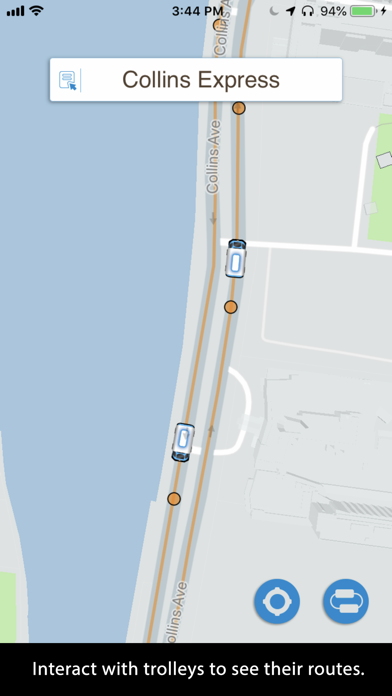
You can track the trolleys and see their routes.
Here is how easy it is to use:
-Touch a trolley to reveal its route. It will show you the name of the route at the top.
-Touch it again to display an animation showing the direction the trolley is moving.
-Zoom into the map to reveal the stops.
-Touch the service name (box at the top of the screen) to see all of the available trolley routes.
-You can hide the trolleys that are not part of the trolley route you selected or you can see the whole network.
-Your location is shown with a blue dot.
Enjoy!
App information from Apple App Store. Miami Trolleys and related trademarks belong to Squideye, Inc..