
Wildfire - Fire Map Info
Track wildfires and weather outlooks
LW Brands, LLC
iPhone Screenshots


iPad Screenshots
Description
Monitor activity with satellite detection, thermal imaging, and weather forecasts. Track large points, view potential indexes, and access national incident reports. Check danger ratings and expected large fires per region.
Download the most comprehensive Wildfire app for iOS.
CURRENT WILDFIRES
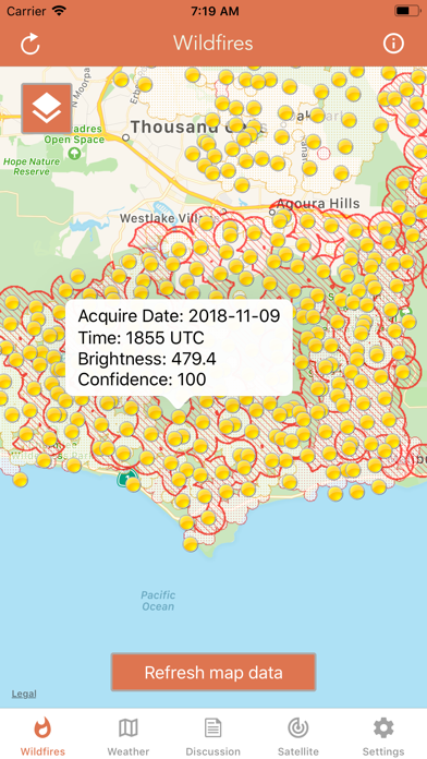
- MODIS Thermal Satellite Fire Detection
- VIIRS IBAND Fire Detection
- MODIS + VIIRS Spot Details
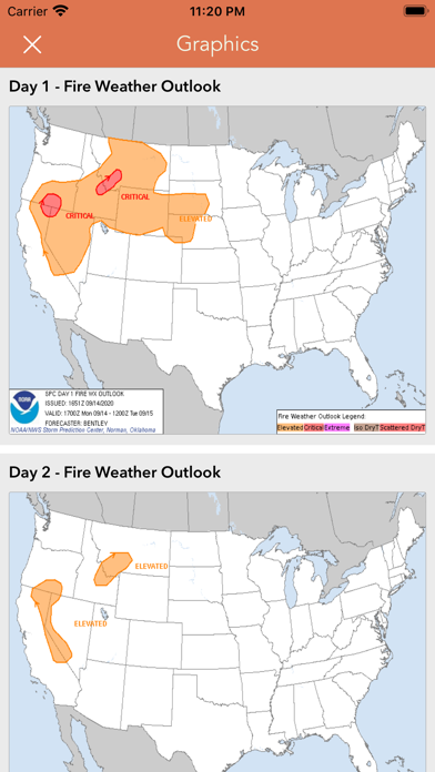
- Fire Weather Outlook: Days 1 - 8
- Large Fire Points
- Dry Thunderstorm Fire Weather Outlook
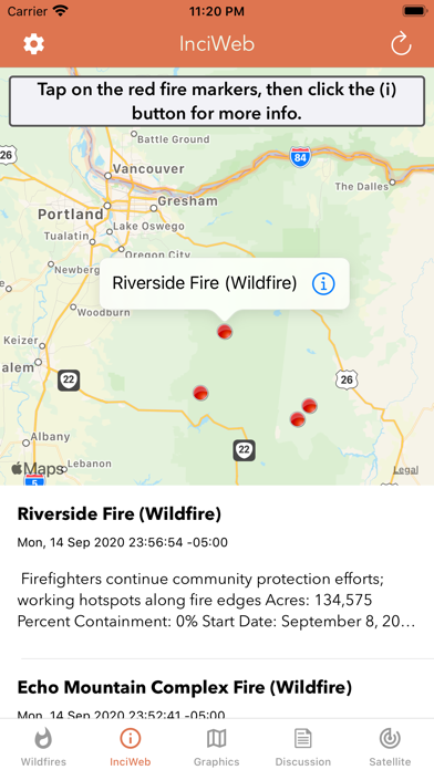
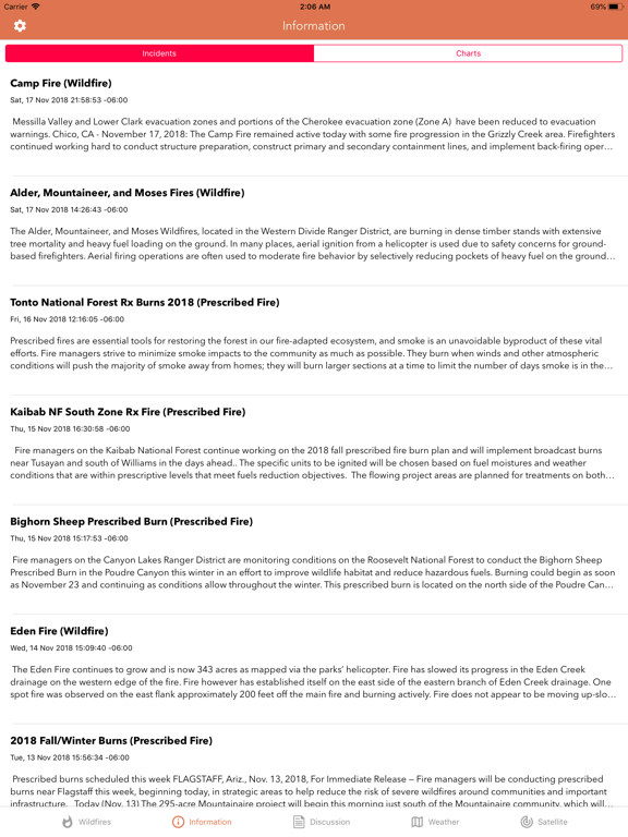
- National Fire Incident Reports
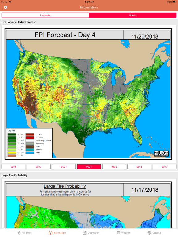
- Fire Potential Index: 7-day Forecast
- Large Fire Probability
- Fire Danger Rating
- Expected Large Fires per PSA
- National Significant Fire Outlook: 4-months
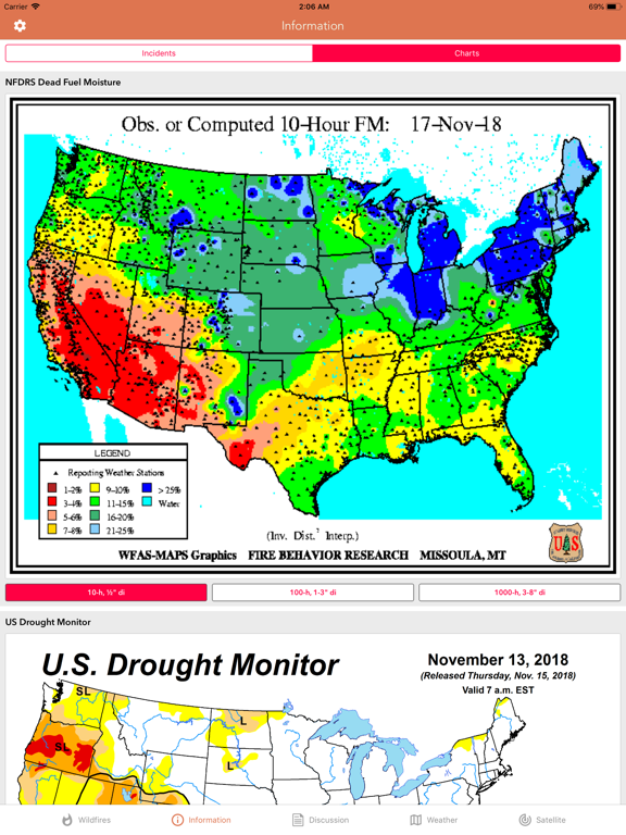
- NFDRS Dead Fuel Moisture
- US Drought Monitor & Index
HAZARDOUS WILDFIRE CONDITION ZONES
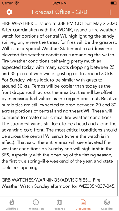
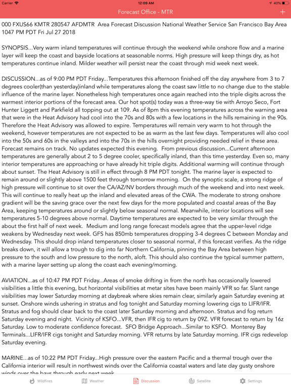
- Detailed NOAA discussion
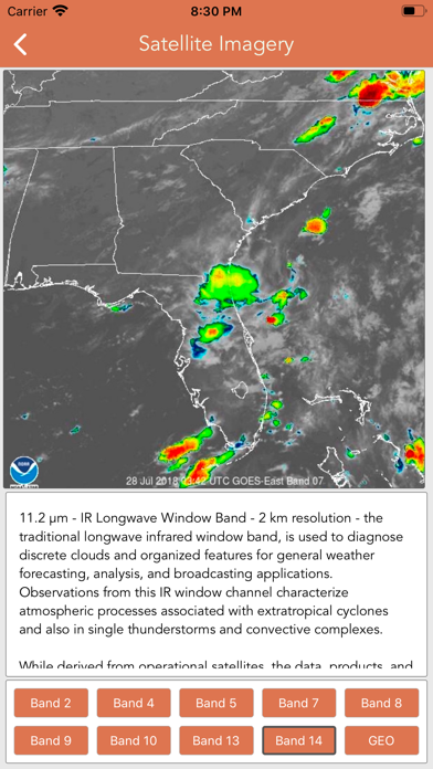
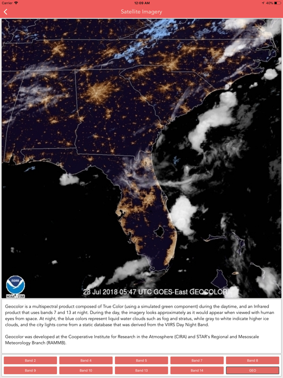
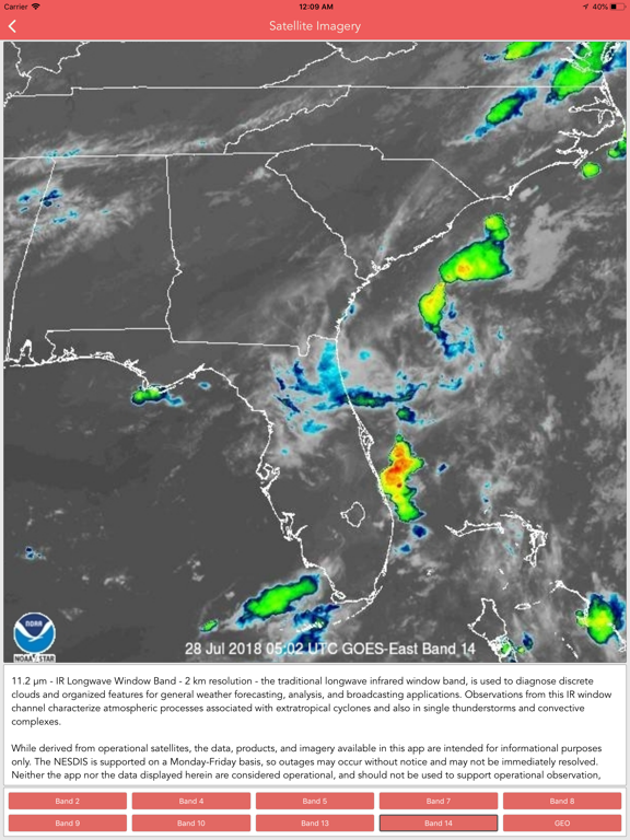
GOES-16 SATELLITE IMAGERY ANIMATIONS
- Regional zones (CONUS)
* Available for iPhone and iPad with single purchase *
Feel free to contact me at [email protected] if you have any questions.
Enjoy.
App information from Apple App Store. Wildfire - Fire Map Info and related trademarks belong to LW Brands, LLC.