
iPhone Screenshots
iPad Screenshots


Description
Plan trips to parks with downloadable and guides. Access 100+ parks, 290+ from federal agencies, and 3,000+ campgrounds. View Motor Vehicle Use and visitor for national forests.
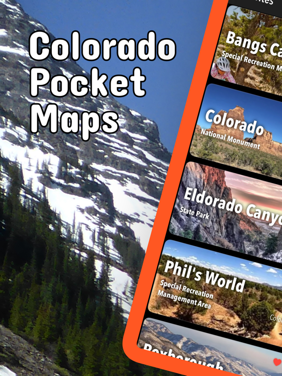
Be prepared! Plan your next trip to one of the great Colorado parks. Download maps and guides before you venture into the Wi-Fi free wilderness.
Discover
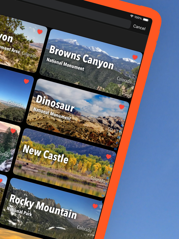
- 100+ national parks, state parks, monuments, forests
- 290+ neatly folded maps by the National Park Service, Bureau of Land Management, United States Forest Services, and other agencies.
- Motor Vehicle Use Maps (MVUM), Motor Vehicle Travel Maps (MVTM) and visitor maps for Colorado national forests.
- 3,000+ campgrounds and campsites
- 6,000+ trails and trailheads
- 64,000+ points of interests
Plan
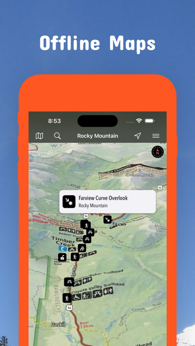
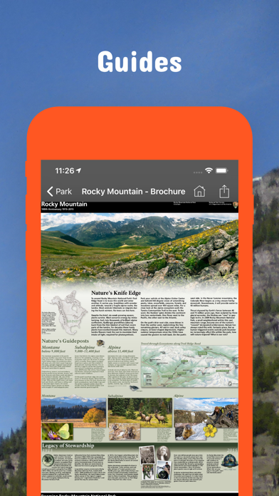
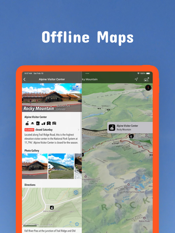
- Download maps, park brochures, and newspapers. These downloads are ready when you are offline and off the grid in the great outdoors.
- Download arbitrary map sections as offline packs.
- Photo galleries, panorama views.
- Share links to parks and maps with friends
Have fun
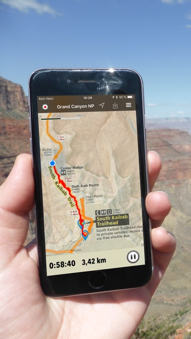
- GPS and GPX support: record your hikes, import GPX routes, tracks and waypoints for your hiking trails.
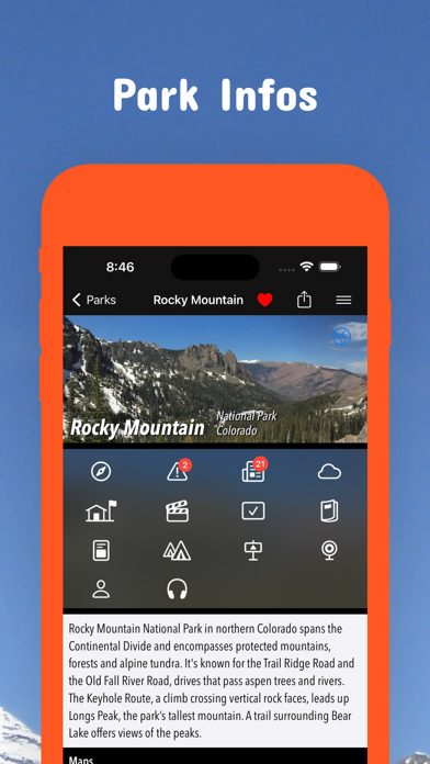
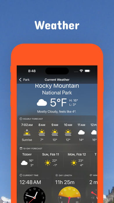
- Detailed national park information: alerts, news, visitor centers, campgrounds, driving directions, weather.
- Open your favorite maps app to get a route to the selected park.
- Current weather conditions, easy access to multi-day forecasts, sunrise and sunset times.
- Push notifications for park alerts, park news, weather warnings
So download maps and guides for:
Arapaho
Arkansas Headwaters
Bangs Canyon
Barr Lake
Black Canyon of the Gunnison
Bocco Mountain
Boyed Lake
Browns Canyon
Bull Gulch
Canyons of the Ancients
Carbondale
Castlewood Canyon
Chatfield
Cherry Creek
Cheyenne Mountain
Colorado
Comanche
Crawford
Curecanti
Dinosaur
Dolores River
Dominguez-Escalante
Eagle
Eldorado Canyon
Eleven Mile
Elkhead Reservoir
Florissant Fossil Beds
Golden Gate Canyon
Grand Mesa
Great Sand Dunes
Gunnison Basin
Gunnison Gorge
Hack Lake
Highline Lake
Jackson Lake
James M. Robb - Colorado River
John Martin Reservoir
King Mountain
Lake Pueblo
Lathrop
Lory
Mancos
Montrose
McInnis Canyons
Mesa Verde
Mueller
Navajo
New Castle
North Sterlin
Pawnee
Perl Lake
Phil's World
Pike
Pisgah Mountain
Ridgway
Rifle Falls
Rio Grande
Rocky Mountain
Roosevelt
Routt
Roxborough
San Isabel
San Juan
San Luis Valley
St. Vrain
Stagecoach
State Forest
Staunton
Steamboat Lake
Sweitzer Lake
Sylvan Lake
Trinidad Lake
Uncompahgre
Vega
White River
Yampa River
There are additional useful information and brochures for many Colorado state parks.
GPS
- Continued use of GPS running in the background can dramatically decrease battery life.
LEGAL
Terms of Use: https://www.icoat.de/pocketmaps/terms
Privacy Policy: https://www.icoat.de/pocketmaps/privacy
App information from Apple App Store. Colorado Pocket Maps and related trademarks belong to Alex Gugel.