
MobileAssessor
Capture photos, sync to parcels, route data
Data Cloud Solutions, LLC
iPad Screenshots


Description
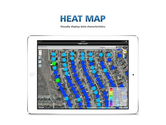
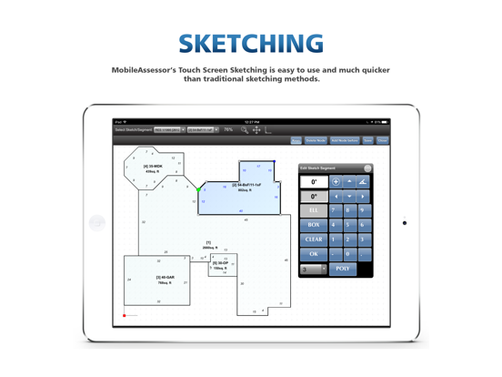
Collects appraisal data with automated routing and photo-to-parcel linking. Syncs images with property records. Uses interactive GIS and GPS maps for location tracking and data management. Allows real-time updates and field data entry.
Appraisal data collection through automated routing, automatic photo to parcel association and synchronization, interative GIS and GPS maps and more!
App information from Apple App Store. MobileAssessor and related trademarks belong to Data Cloud Solutions, LLC.