

Apps Like Altimeter - i for iPhone and iPad
Track altitude, max, and min elevation
Display current, maximum, and minimum altitude using GPS. Switch between meters, feet, and yards. Adjust scale increments of 10, 100, 1000, or 10000. Track altitude changes during hiking or travel.
Altimeter - i screenshots
Ranked alternatives
Showing 301–320 of 1,000 ranked alternatives.

OpenADSB
Steve Kuo
Track aircraft and view flight data
Track aircraft using real-time data from multiple air traffic sources. Display flight paths, altitudes, and speeds. Customize map views and set up alerts for specific aircraft. Connect to dump1090, tar1090, or Virtual Radar Server.

Precision Cut Archery
Precision Cut Archery LLC
Calculate trajectories and adjust sights
Calculate ballistics for with offline-ready shot solutions. Input sight marks, short range marks, and altitude cuts for accurate adjustments. Sync bow and arrow setups with a web account.

FlightCALC-HD
Felix Steger
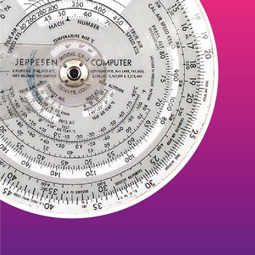
Altitude, speed, temperature, wind, turns.
The app performs altitude, speed, temperature, wind, and turn calculations. It includes unique calculations for bank, radius, and acceleration, along with various wind computations.


RemoteFlight LITE
Vladislav Oupicky
See flight simulator aircraft data.
The app displays an aircraft's connection status, type, altitude, and airspeed when loaded in Flight Simulator or X-Plane. It requires the RemoteFlight Server utility for device connection.

Car Finder - Car Locator
Gerard Grundy
Find car location with GPS and photo
Uses GPS to save and retrieve vehicle locations. It takes photos of car positions and uses altitude data to indicate parking level directions. It provides step-by-step guidance for finding cars parked near visited locations.

Lirum Device Info
Lirum Labs Technologies Inc.
Monitor specs and sensor data
Displays real-time CPU and memory usage. Shows battery level and charging status. Provides live sensor data including accelerometer, gyroscope, and barometer. Displays location with accuracy and altitude. Shows Bluetooth LE advertisement details.


SnapLab ‑ Camera & Filter
瑶佳 薛
Record with templates and watermarks
Record data with pre-designed templates for engineering, office, and field use. Automatically fill in time, location, weather, and device info. Add custom watermarks and save entries with timestamps.

AvPlan EFB
BJA Consulting Pty Ltd
Navigate, plan, and fly with precision
Plan flights with terrain warning, restricted airspace status, and IFR airway planning. View geo-referenced taxi and approach diagrams. Manage flight data, check weather, and access navigation charts.


TRASOL
Desert Tech LLC
Calibrate settings and track performance
Track and capture moving targets with real-time ballistic adjustments for density altitude, Coriolis, cant, and slope. Calibrate settings with a tap. Record video and photos. Sync with a heads-up display for precision shooting up to 5000 yards.

GPS Real-time Altitude Meter
海英 王
Track and air pressure in real time
Monitor , air pressure, and oxygen levels in real time using GPS and sensor data. Customize theme and background. Track environmental changes with precise measurements and dynamic updates.

Lightning Distance Calculator
Gianluca Natalini
Calculate lightning distance from storm.
The app calculates the distance between lightning and the user's location. It measures the distance in meters and feet based on user input when lightning is seen or thunder is heard.

SunFlight
Michael Gehringer
Sunrise and sunset times during flight.
The app calculates sunrise and sunset times during flight. It manages timings for prayers and fasting, providing predictions along the shortest route corrected by flight altitude.
Range-Finder
Savvas Petrou
Measure distances to a target.
The app measures distances to a target using the device's camera. It calculates estimated distance and altitude after the user aims at a target, moves a set distance, and aims again.

PFMA E6B
Gonzalo Esteban Astica Capra
Manage flight data and calculate fuel burn
Navigation provides flight planning and in-flight calculations. Users can customize quick access buttons, configure units, and manage blocks and airtime.

Best Taxi Meter
Muhammad Saeed
Customize, track, and charge rides
Track trips with real-time maps and directions. Customize settings for accurate metering. Record and export trip history with sorting options. Charge passengers for rides and manage multiple trips.
How we rank alternatives
Apps are ranked by functional similarity, category fit, rating confidence, and popularity.