The app provides information on nautical services and activities in Quebec. Users can consult and view marinas, nautical stations, activities, traders, and retailers, and locate their position relative to service points.
by 9322-5613 Quebec Inc★ 0.00 ratingsNavigationFreeData updated 2026-11-04
Book boat slips and moorings at marinas, yacht clubs, and boatyards. View amenities, photos, and pricing. Request and manage reservations. No additional costs for users. Syncs with Apple Health.
Track outdoor activities like hiking, biking, walking, and running with GPS. Save and navigate to waypoints. Store favorite destinations. View activity logs and maps. Share routes and track progress.
Browse digital maps with multiple view options including standard Apple Maps, satellite, hybrid, USGS topographic maps, orthophotos, NOAA nautical charts, and Open Street Map. Navigate, zoom, and search for locations across different map layers.
Access for the USA, Canada, UK/Ireland, Germany, Netherlands, and European rivers. View NOAA vector , freshwater lake maps, and USACE inland river maps with bathymetry data. Create or import GPX/KML routes. Use voice prompts for route navigation.
Calculate sunrise, sunset, moonrise, and moonset times for your location. Track solar noon, day length, and equation of time. View declination, twilight phases, and azimuth angles. Monitor seasonal dates, solstices, and equinoxes.
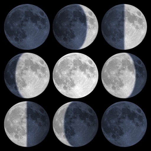
Calculate sunrise, sunset, moonrise, and moonset times based on GPS location or selected locations. Track moon phases and twilight times. Save multiple locations and sync calendars for upcoming events. Support timezone selection and iPad Split View.
Distances between waypoints or calculate surface areas using map polygons. Set waypoints by tapping and holding. Choose units like kilometers, miles, or nautical miles. Access settings to change map type or view the manual.
The app displays sunrise, sunset, and sun direction for any day and location. It provides civil, nautical, and astronomical twilight times, along with the Sun's elevation and azimuth, and shadow ratio.
Distances between two or more points on a map. Place markers to calculate straight-line distance. Sum total distance for multiple locations. View distance in kilometers or miles.
View detailed navigational charts offline with multiple overlays. Access real-time data and historical information. Plan routes and track progress. Set waypoints and measure distances. Sync with other devices for collaborative navigation.
Calculate -related conversions, fuel consumption, and navigation metrics. Perform arithmetic operations and unit conversions. Track time, distance, and speed. Sync with Apple Watch for real-time updates.
The app provides real-time NOAA buoy data including tides, wave height, wind speed, and atmospheric details. Users can explore a global marine map, access detailed charts, and receive location-specific forecasts for iPhone, iPod, and iPad.
Track tides and marine weather with real-time forecasts and buoy observations. View NOAA marine reports and weather data. Plan activities like fishing, boating, or beach trips. Set alerts for changing conditions.
View and manage files with customizable map displays. Import files from cloud services, local devices, or emails. Choose between Apple Maps, Google Maps, OpenStreetMaps, or custom tile sources. Adjust colors for waypoints, track points, and routes.
Track routes, find waypoints, and navigate offline
Navigate outdoors with offline GPS maps and real-time augmented reality. Track waypoints and custom locations. Use a gyrocompass, speedometer, altimeter, and inclinometer. Find celestial bodies and measure angles.