

Apps Like Map It Vilas County for iPhone and iPad
Find trails, view maps, filter by activity
View interactive maps of trails. Search and filter by activity, length, location, and amenities. Plan routes for snowmobiling, ATVing, biking, hiking, and cross-country skiing. Access trail details and navigation features.
Map It Vilas County screenshots
Ranked alternatives
Showing 661–680 of 1,000 ranked alternatives.


iSKI Czech - Ski & Tracking
intermaps Software GmbH
Track ski routes and weather in real
Check ski resort details, view digital trail maps, and access real-time weather reports. Track snow conditions and livecams. Use GPS to record skiing activity and locate trails. Find up-to-date information on ski resorts.


Where to sleep? Rental, Bnb, Activity - KooKooning
KAPT
Combine activities and accommodation for stays.
The app allows users to prepare themed stays by combining activities and accommodation. Users can find a stay adapted to their desires for various occasions, with a wide variety of options available.

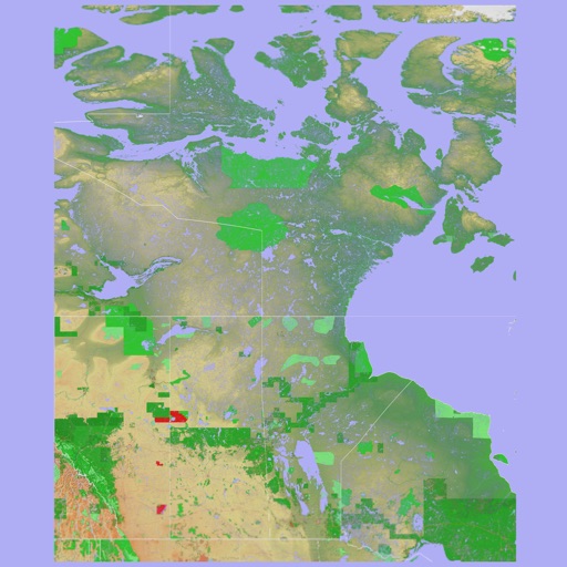

Scenic Map Eastern Canada
Mark Granger
3D topographic map of Eastern Canada
The app presents a 3D topographic map of Eastern Canada. Users can download map data for use without an internet connection, suitable for various travel methods.


iSKI France - Ski & Neige
intermaps Software GmbH
Ski resort information and GPS tracker.
The app provides ski resort information including maps, weather, and live cameras. It features GPS tracking to record skiing activity, analyze performance, and share achievements with friends.



Guided by Nature in Portugal
Outdooractive AG
Navigate trails offline and plan routes
Plan outdoor trips with offline maps for navigation in remote areas. Discover activities, dining, lodging, and attractions on a single map. Access essential tourist information and local points of interest.


How we rank alternatives
Apps are ranked by functional similarity, category fit, rating confidence, and popularity.