
Apps Like Partition & Stakeout for iPhone and iPad
Digitize and divide real property easily.
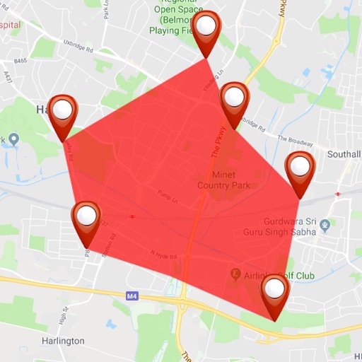
The app allows users to digitize and divide real property into sub-areas. Users can record GPS locations, pick GPS locations for lines or areas, and use stakeout functions to approach points or move along boundaries.
Partition & Stakeout screenshots
Ranked alternatives
Showing 221–240 of 1,000 ranked alternatives.

AGRIplot
Sharpe Technology Consulting
Plot areas and calculate distances.
The app plots areas on a map by adding landmark points or dropping pins. It calculates enclosed area and distances between points, with options to add interest points and photos.


Zip & Location Finder
Alera Enterprises, Inc.
Find zip code, address, and coordinates.
The app uses GPS to identify the zip code, address, and GPS coordinates of the current location. It functions in US locations and almost any international geography.


NZ Topo Maps
Rajan Fernandez
Download , find huts, track trails
Access offline topographic of New Zealand. Download and manage to conserve storage. Locate DOC huts, campsites, and hunting areas. Search for named locations. Import GPX routes and share via AirDrop. Measure distances on .



DMS Converter
Geospike Pty Ltd
Convert Decimal Degrees to DMS
The app converts between Decimal Degrees and Degrees/Minutes/Seconds notation. It allows viewing converted coordinates in Maps or sending them to GPS Log.

NodeMapp Bike
NodeMapp
Plan routes and view nodes on
Plan and save customized routes using a map-based interface. Set start points and desired distances for automatic route calculations. Save routes for future reference.


GPS Maps & Driving Directions
Mudassar Ahmed
Navigate with real-time routes and 3D
Find routes with real-time traffic updates and voice-guided . View 3D aerial and use a digital compass for orientation. Plan trips with AI-generated itineraries and track progress toward destinations.

Altimeter Pro - Altitude & Map
海英 王
Measure , track air pressure, customize themes
Measure in real time using GPS and sensor data with less than 3-meter error. Track air pressure and oxygen concentration. Customize themes for personalized backgrounds.


Austrian Map Mobile
Garzotto GmbH
Digital maps of Austria with features.
The app provides digital maps of Austria with hill shading and object names. It includes topographic maps and offers functions like searching by name or coordinates, GPS features, and measuring distances.

Upshur Rural
Upshur Rural Electric Cooperative Corporation
View usage, manage payments, notify support
Manage account balance and due dates, set and modify payment methods, view bill history with PDF access. Notify customer service of issues and receive special messages. Track usage and billing details.

Screenshot Pixel Measure Tool
InfoEnum Software Systems
Dimensions in screenshots and photos
Dimensions, spacing, and angles in screenshots and photos. Analyze color values, grid alignment, and element positions. Export measurements and compare dimensions across images.

How we rank alternatives
Apps are ranked by functional similarity, category fit, rating confidence, and popularity.