Calculate distance and heading along great circle.
The app calculates distance and heading along the great circle between two positions. It uses GPS for the start position or allows own input, and provides GPS speed and course.
by Lars Hansen★ 1.01 ratingsNavigation$0.99Data updated 2026-10-30
Provides readings using either device GPS or the ASTER digital elevation model. Displays accurate elevation data with a horizontal accuracy of 30 meters. Functions on devices without a GPS sensor.
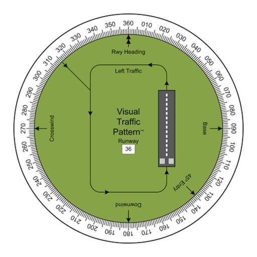
Allows pilots to view runway patterns with finger rotation. Display includes left and right patterns, crosswind, downwind, base, and 45-degree entry headings. Magnetic runway orientation matches aircraft heading for approach visualization.
Track speed with GPS precision for driving, cycling, running, or walking. View real-time speed in mph, km/h, or knots. Log trip details including distance, time, and average speed. Customize display settings for different activities.
Find prayer using device compass and GPS. Display bearing and compass needle. Set location manually or automatically. Works offline and without internet. No location data is shared. Adjust compass for accurate readings.
The app controls the Maginon GPS tracker using an iPhone or iPad. Users can view the tracker's position and history, and configure all settings after installation.
Create and manage custom circles on Google Maps with precise mile measurements. Add markers and save locations for real estate, delivery, or business planning. Export map data and share visualizations for location-based analysis.
Add time stamps, GPS coordinates, and exact addresses to photos and videos instantly. Enable grid, aspect ratio, switch, flash, focus, and timer settings. Store user locations automatically and reverse-geotag addresses.