Learn about invasive species through interactive content. Identify species by image and location. Track spread patterns and report sightings. Access impact data and prevention tips. Share information with others.
by Charles T. Bargeron★ 4.863 ratingsEducationFreeData updated 2026-09-09
Citizen scientists detect invasive species arrival.
The Invaders of Texas Citizen Science program collects species observations from volunteers. Volunteers use a kit to detect and report invasive plant species in their local areas.
The Sealife Tracker project collects data on marine species along the UK coastline. This project involves a partnership between multiple organizations focused on marine life and environmental protection.
Identify and tag healthy trees in local areas. Upload photos and location data for scientific research. Contribute to studies on tree resilience and forest health.
Record and submit observations of invasive species with GPS coordinates. View distribution maps and search for species by location. Receive alerts about new sightings and contribute data to a centralized database.
The app allows users to identify and report invasive species in the Great Lakes region. Submitted reports are uploaded to EDDMapS and sent to verifiers for review.
Explore an interactive map of . View points of interest and amenities. Access digital tours for educational content. Support conservation efforts through in- donations. Learn about history and restoration projects.
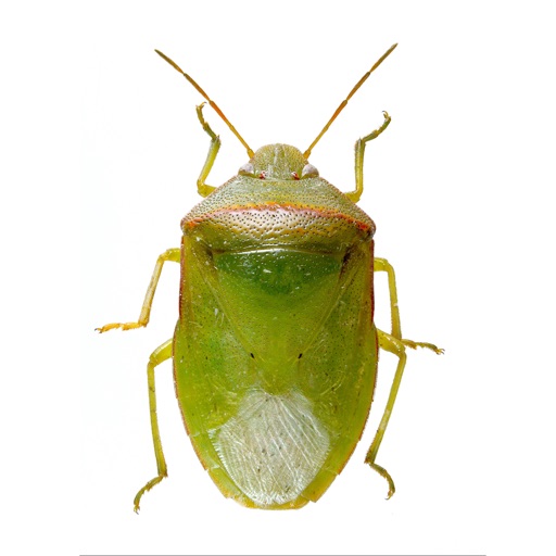
The app identifies common stink bugs in Georgia and the southeastern US. It provides images of eggs, nymphs, and adults for most species, with key characteristics highlighted for easy identification.
Identify bird species through photo or sound. Receive alerts when visit. Get collectible postcard photos. Learn bird facts. Sync with smart bird feeder. Share sightings and track visits.