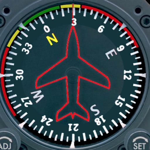
Rally racing navigation instrument for motorcycles.
The app offers an adjustable odometer and a CAP heading compass on its home screen. It is suitable as a primary or backup navigation device for rally racing.
by PepeRico, LLC★ 5.03 ratingsNavigation$19.99Data updated 2026-10-22
Measure distances and angles using a rangefinder and inclinometer. View real-time compass direction and GPS location. Overlay maps and take geo-tagged photos or videos. Calculate navigation routes and track elevation changes.
Calculate pressure and density altitudes, true airspeed, and mach number. Determine wind correction angle and true heading. Compute crosswind, headwind, and tailwind. Find ground speed and flight time. Calculate fuel burn and cloud base.
Displays daily activity data from Apple Health as customizable on the home screen. Users can track walking and running distances, set personal s, and view progress over different time periods.
The app displays PDF roadbooks from a Dropbox folder, storing them locally for access anywhere. Users can advance or rewind the display using the touchscreen or Bluetooth audio controls.
Record and synchronize master time with auto-splits and "next minute" features. Track race chronometer and countdown timer. Use service park-mode timer with spoken time alerts.
Calculate speed and distance traveled. Tap the screen to reveal control buttons. Hide buttons after five seconds. View settings and information windows.
View topographic of the United States with options for standard or hybrid map sources. Download for offline use and track current location on the map. Navigate using map features and explore terrain details for outdoor activities.
Displays a photorealistic -style indicator with both analog and digital readouts. Users can toggle rotation lock, simulate the instrument indoors, and view improved graphics. Supports latest iOS versions and includes bug fixes.
The app provides navigation for outdoor activities, allowing users to view their location in UTM or Lat/Lon. It supports recording and returning to waypoints, track logs, and exporting data to KML, GPX, or CSV files.
Track cycling routes with GPS/GLONASS for location, speed, and elevation. Monitor power via Bluetooth or ANT+ sensors. Record cadence and compensate for single-side power meters. Save and review ride data. Sync with Apple Health.
Track departures and arrivals with real-time updates. View delays, cancellations, and gate information. Find terminal details and receive notifications for schedule changes. Check airport maps and locate security checkpoints. Share with contacts.
The app provides a visual 3D ballistic tool for practicing hunting situations up to 1000m. Users can practice with adjustable rifle scope, ballistics, and environmental variables, then analyze their hits.
Calculate distance and heading along great circle.
The app calculates distance and heading along the great circle between two positions. It uses GPS for the start position or allows own input, and provides GPS speed and course.
The app provides a precise GPS tripmaster for off-road, overland, and rally driving. It measures distance, follows roadbooks, and offers voice announcements to keep drivers focused on the trail.