
Apps Like iTracker for iPhone and iPad
GPS based telemetry logger stores data.
The app logs real-time location data at user-defined intervals. Journey information displays on a map or through a CSV and GPX viewer, with routes exportable via email and clipboard.
iTracker screenshots
Ranked alternatives
Showing 261–280 of 1,000 ranked alternatives.


Speedometer GPS- Speed Tracker
TECHISTIC LTD
Track , distance, and performance
Track , distance, and performance with real-time GPS data. Display in mph and km. Log trips and view historical records. Set alerts and monitor journey details. Sync data across devices for ongoing performance analysis.

Trail X Trail
Trail X Trail LLC
Map, record, and track trails
Create and navigate custom routes with multi-stop routing. Manage waypoints and record tracks from rides. Save and review recorded routes for future reference.

Looking4Cache Lite
Michael Andreas May
Search, store, and log geocaches offline.
The app allows users to search for geocaches using the Geocaching Live API or by importing GPX files. All geocache data is stored locally for offline use, and users can log finds and trackables within the app.

Speedo - Speedometer GPS
Minh Nguyen
Track speed, view odometer, log trips
View current speed with a scalable . Track total distance and trip data including max and average speed. Export trip data as GPX, CSV, or KML files. Receive alerts when speed exceeds or falls below set limits.
Keto Logger
Uncomplicated Solutions Inc.
Log glucose and ketone readings
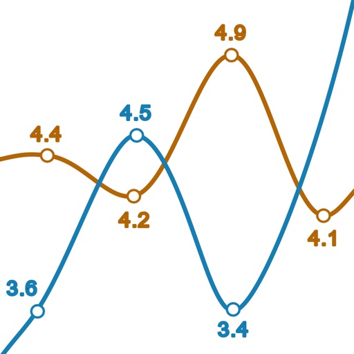
Log glucose and ketone levels with entry screens supporting mg/dL and mmol/L units. Import CSV files from KetoMojo meter. View line graphs comparing glucose and ketone readings. Navigate between date ranges for progress tracking.


Coordinates Lite
Hunt Mountain Software
Convert between formats
Convert between decimal degrees, degrees and decimal minutes, and degrees-minutes-seconds. Display all three formats simultaneously. Enter in any format for instant conversion.

New Mexico Pocket Maps
Alex Gugel
Download and guides for New parks
Plan trips to New parks with downloadable and guides. Access 90+ parks, 150+ folded from government agencies, and 600+ campgrounds. View 2,000+ trails and motor vehicle use for navigation in areas without Wi-Fi.

Harry's Sailor
Harald Schlangmann
GPS navigation tool for sailing companion.
The app provides GPS-based navigation and sailing assistance. It displays heeling, racing rules, and navigation data, with integrated Google Maps and a trip recorder.

Idaho Pocket Maps
Alex Gugel
Download and guides for parks
Plan trips to parks with downloadable and guides. Access 45+ parks, 190+ from government agencies, and 1,600+ campgrounds. View trails, motor vehicle , and visitor information. Navigate without Wi-Fi in wilderness areas.

Wyoming Pocket Maps
Alex Gugel
Plan trips and download offline
Plan trips to parks with downloadable and guides. Access over 70 parks, 140 folded from various agencies, and 1,600 campgrounds. View 2,600 trails and motor vehicle use for navigation in areas without Wi-Fi.

Alaska Pocket Maps
Alex Gugel
Plan trips, download , explore parks
Plan trips to parks with downloadable and guides. Access 60+ parks, 200+ from government agencies, and 400+ campgrounds. View 800+ trails and motor vehicle use for navigation in Wi-Fi free areas.


AnchorQueen Jules
Barkin Takmaz
Monitor anchor position in real time
Monitor boat position and anchor status in real time. Receive alerts if the anchor drags or moves unexpectedly. Track vessel location and set custom alarm thresholds. View historical data and manage settings for multiple vessels.
Smart Wristband 3
永坚 郑
Sync data, track sleep, share stats
Track fitness activities, monitor heart rate, and log workouts. View real-time stats and daily summaries. Sync sleep data to analyze quality and duration. Share progress with friends and compete in challenges.
How we rank alternatives
Apps are ranked by functional similarity, category fit, rating confidence, and popularity.