

Apps Like Wasatch Backcountry Skiing Map for iPhone and iPad
Navigate and explore trails
Displays current location using GPS on a high-resolution topo map. Includes an index to over 1,000 locations in Utah’s Central mountains. Allows users to navigate trails, view elevation data, and access detailed route information.
Wasatch Backcountry Skiing Map screenshots
Ranked alternatives
Showing 141–160 of 1,000 ranked alternatives.


Spartan Forge: Hunt
Spartan Forge LLC
Find land boundaries and units
Plan hunts with detailed LiDAR maps, satellite imagery, and deer movement predictions. Access land boundaries, ownership data, and parcel change alerts. Customize LiDAR layers and overlay crop data for strategic scouting.

GPS Navigation & Map Direction
Zia Ur Rahman
Find routes, track location, view nearby places
Find routes and get turn-by-turn . View current location and nearby places. Receive directions for accurate destination arrival. Display maps with real-time location tracking. Show nearby points of interest.

Skate Snowboarding - Ski Games
Survival Games Production
Snowboard tricks and stunts
Play a freestyle game with customizable skateboards and stunts. Perform tricks on mountain slopes and ice surfaces. Compete against other players in skateboarding challenges. Unlock new boards and upgrade skills through gameplay.

iHikeGPS : Classic Topo Maps
James Associates Inc.
Navigate with topographic and GPS
Track location and movement with GPS. View USGS, US Forest Service, and Canadian . Log trails and waypoints. Navigate offline in areas without cell signal. Display elevation and terrain details. Share route data and historical tracks.


AR AlpineGuide
NYANKO SOFTWARE
Point your device to see mountain details
Point your device at a mountain to see its name, altitude, and distance. Identify peaks in a 360-degree AR view. Access data for nearly one million peaks worldwide. Uses 3D coordinates and gyroscope for accurate display.


We Ski & Snowboard Tracker
Xovation Corporation
Track ski runs and view 3D trail
Navigate slopes with 3D trail maps styled for winter. Track live friend locations and view public/private leaderboards. Log detailed stats, check lift wait times, and access offline maps. Sync with wearable devices for real-time performance data.
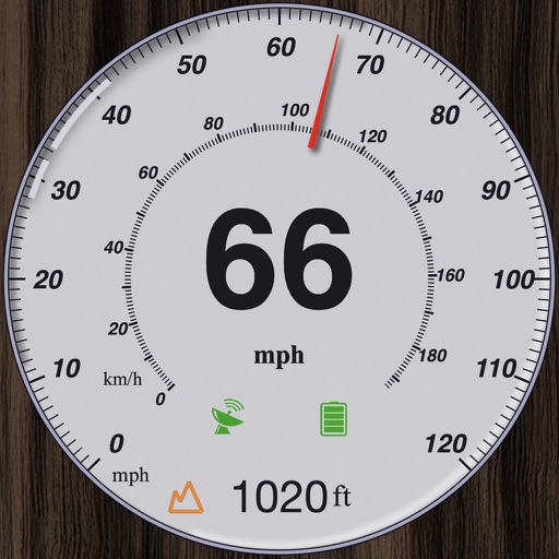
GPS Speedometer and Altimeter
晓溪 张
Track speed with dual scales and unit
GPS measures and displays speed for walking, jogging, cycling, cars, boats, trains, and airplanes. Users can select display units and choose between two scales. Trip recording and average speed tracking are available.





Denver Post Sports
Denver Post
Watch live scores and game highlights
Customize news feeds with filters for teams and events. Save articles for later reading. Get live scores, breaking news, photos, stats, and video highlights. Receive team-specific alerts. View commentary and watch game highlights.

How we rank alternatives
Apps are ranked by functional similarity, category fit, rating confidence, and popularity.