Apps Like Camera Measure - PartoMeter for iPhone and iPad
Objects with your phone
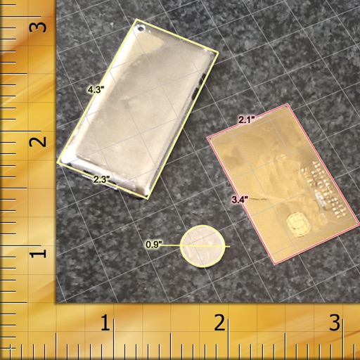
Object dimensions using phone and reference objects like credit cards or DVDs. Snap photos for accurate in-plane measurements. Add custom reference objects with known sizes. Export measurement data for later review.
by VisTech.Projects LLC★ 3.864 ratingsUtilities$2.99Data updated 2026-09-08
Convert units, track measurements, and share results
Measure and convert units for length, weight, temperature, speed, and . Use the built-in ruler tool to measure distances. Convert between units within categories. View conversion history and save frequently used conversions.
Access and explore BIM models online or offline. Collaborate with team members by marking up and measuring models. Sync projects efficiently and review changes in real time. Share feedback and track project progress across devices.
Measure size using a reference object and photos. Check if dimensions meet airline hand requirements. Instantly receive size compliance results. Share measurements with airline staff if needed.
Capture building dimensions and areas by taking a single photo. Measure walls, roofs, windows, and doors accurately. Export measurements and save project data for future reference.
Measure leaf surface area with high accuracy using a mobile device. Log measurements and export data as CSV. Share files via AirDrop, email, or other methods. Requires a white background with reference markers.
Measure distances and dimensions using AR and camera. Tap to place markers and view real-time measurements. Save and share measurements. Sync with other devices. Adjust for scale and unit preferences.
Create routes for running or walking by tapping on the map. Calculate distances and areas on the map. Plot routes and get automatic directions. traveled and save route data. Sync with fitness trackers for step and tracking.
Calculate land using GPS coordinates. Draw shapes on maps to fields or plots. Add GPS stamps to photos with location, time, weather, and compass data. View live maps and magnetic information.
Measure land , distance, and perimeter using real-time GPS. Mark points on a map to calculate fields, plots, and paths. Switch between and distance modes. Supports units like acres, hectares, and square feet. Save and export data.
AR measuring lets users tap two points on the camera screen to measure object lengths. Auto convert button changes units. performs basic math functions.