

Apps Like Hold Entry Calculator for iPhone and iPad
Ranked alternatives
Showing 61–80 of 1,000 ranked alternatives.

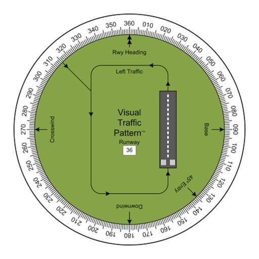
Visual Traffic Pattern
Arthur Varrassi
View runway patterns with finger rotation
Allows pilots to view runway patterns with finger rotation. Display includes left and right patterns, crosswind, downwind, base, and 45-degree entry headings. Magnetic runway orientation matches aircraft heading for approach visualization.


Altimeter for Aviators
M Butler
Measure altitude using barometric pressure
Measure altitude using barometric pressure without GPS. Display real-time altitude readings. Track pressure changes over time. Set altitude alerts. Sync with Apple Watch for stand-alone use.

TZ iBoat – Marine Navigation
Nobeltec, Inc.
Navigate with real-time GPS and tidal data
Navigate using GPS, AIS Online, and radar. View charts for coastal boating, sailing, and fishing. Track tides and currents. Set anchoring points. Sync with Apple Health. Share routes and waypoints.

KickMap NYC
KICK Design Inc
Plan trips, navigate streets, track location
Plan trips with route calculations between locations and stations. Receive real-time service updates via push notifications. View transit schedules and service advisories. Navigate subway systems with clear maps and directions.


SkyPilot GPS Dashboard
Christoph Schulz
Track location, speed, and heading
Track location, speed, altitude, and heading using built-in GPS. Customize with widgets for quick access. View real-time movement data and adjust settings for navigation.

SatFinder Pro HD Dish Pointer
Yuriy Kvasha
Find satellites, point device, view signal
PRO HD helps users locate satellites by pointing their device skyward. It displays available satellites and their parameters. Users can sort satellites by name or frequency. Search functionality allows filtering by channel, radio, or provider.

B737 Cockpit Companion
Flight Simulation Systems, LLC
B737 systems guide for pilots.
This app provides detailed information on B737 systems, including the NG, Classics, and MAX models. It offers customizable content, touch navigation, and reference options for pilots.

EasyCockpit
Aviation.Direct (Pty) Ltd
Aviation navigation for Southern Africa.
The app provides aviation navigation for Southern Africa with a GPS moving map and detailed airfields database. It includes airspace information, flight planning, and an E6B calculator for enhanced situational awareness.

AltitudeAlert
Raymond Chase
Set altitude alerts and track vertical navigation
Manage altitude with customizable VNAV settings for precise control. Set altitude alerts and use ALT HOLD mode for minimal setup. Track vertical navigation parameters and adjust flight paths accordingly.
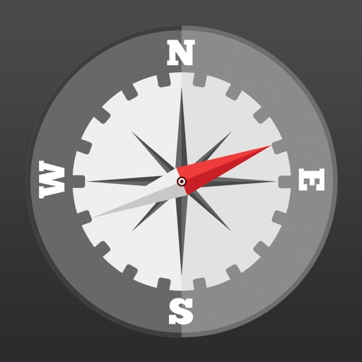
Compass Heading- Magnetic Digital Direction Finder
Flamethrower plc
Navigate with and flashlight
Displays current with a large degree reading and a pointing arrow. Shows cardinal directions and a rotating rose. Includes a flashlight for low-light visibility. Provides accurate north orientation for land and marine navigation.

IKabe
mahmut keygubatli
Direction to Kaaba and sun compass.
The app calculates the distance and direction to the Kaaba. It also shows the sun's direction and visibility, updating the sun position every minute.

AvPlan EFB
BJA Consulting Pty Ltd
Navigate, plan, and fly with precision
Plan flights with terrain warning, restricted airspace status, and IFR airway planning. View geo-referenced taxi and approach diagrams. Manage flight data, check weather, and access navigation charts.

FlightSight
Timothy Kelley
Determine flight path relative to objects
Determine flight path relative to objects by positioning the sight target on cloud tops, mountain passes, or other aircraft. Receive visual indication of whether the object is higher or lower and the degree difference.

Mapper for Safari
Alex Kitcoff
Open Google Maps links in Apple Maps
Redirect Google Maps links, addresses, and direction buttons to Apple Maps without copying text. Support all Google domains on iOS and macOS. Automatically fallback to Google Maps web if redirection fails. Open map thumbnails directly in Apple Maps.

The Muslim Pilot
MOHAMMED AL OTAIBI
Calculate prayer times with flight data
Calculate prayer times during flights using waypoint coordinates and altitude. Determine prayer times en route with ground speed and track data. Sync with flight plans for accurate timing.

How we rank alternatives
Apps are ranked by functional similarity, category fit, rating confidence, and popularity.