Adds date, time, and location overlays to photos and videos. Users can customize text, images, and coordinates. Automatically stamps media with accurate time, date, and GPS data.
Track vehicles in real time using GPS. View location updates, monitor movement, and receive alerts. Manage fleets, track school buses, and oversee assets. Set up employee schedules and access vehicle data remotely.
Find latitude and longitude coordinates of your current location in decimal degrees and degrees-minutes-seconds. Tap coordinates to copy to clipboard. Save coordinates with a custom name. Share coordinates via email or messaging.
Locate yourself on OS maps using GPS and compass. View current grid reference and heading. Convert coordinates with OSTN02 for accuracy. Track easting, northing, and tetra. Includes Apple Watch and complication.
The app calculates the shortest distance or distance with a constant bearing between two locations. Users can select current location, enter coordinates, or choose from a database.
Receive location data via email and map it automatically. Visualize GPS coordinates with a radius overlay. Get notifications for location updates. Share mapped locations with others. Set custom radius sizes and track movement patterns.
Display GPS coordinates in DMS, DDM, or DD formats. Show altitude in feet or meters. Track speed with a speedometer. Share coordinates. Switch between magnetic and geodetic north. Use flashlight for nighttime. Provide location data.
Create and manage custom circles on Google Maps with precise mile measurements. Add markers and save locations for real estate, delivery, or business planning. Export map data and share visualizations for location-based analysis.
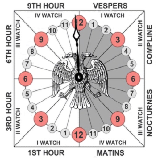
Track prayer times based on time calculations. Adjust for location using GPS or manual input of coordinates. Display times in 12-hour format starting at evening. Include historical context about ancient Judean timekeeping methods.
View current location details including latitude, longitude, altitude, and address in Decimal or DMS format. Track trip data such as distance, speed, and maximum speed. Save location and trip information for later review.
Track vehicle locations in real time and view location history for trips. Set and monitor geofences. Receive alerts for vehicle movements. Access data from multiple tracking services including S.A., SkyData Panama, and MexTrack.
Allows users to access and monitor iPhone sensors like GPS, accelerometer, gyroscope, and barometer. View real-time from each . Export readings as CSV files. Create custom combinations and visualize graphs.