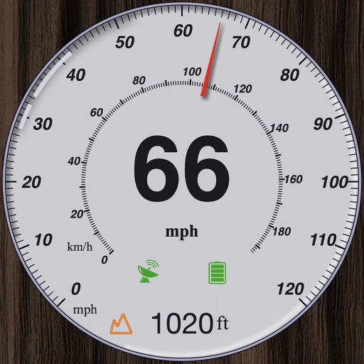
Track speed, distance, altitude, and heading with real-time GPS data. Record trips with route tracking and save journeys for later. View live maps with position updates. Export trip data for analysis.
GPS tracks current speed, distance, and altitude. Displays average and maximum speed. Shows speed limits in real time. Supports mph, km/h, and knots. Measures travel time and battery level. Works offline.
Receive real-time alerts for , traffic updates, and limit changes. View specific notifications for cars, motorcycles, trucks, and commercial vehicles. Access offline detection features and track limits while driving.
GPS speedometer displays real-time speed for driving, biking, or walking. Measure trip distance offline. Track altitude for planes. Switch between mph, km/h, and knots. Use Today Widget or Apple Watch. Adjust screen color and toggle mirror .
Track , distance, altitude, and heading in real time with GPS. View live position on an interactive map. Record trips with detailed route mapping and save journeys for later review. Switch to HUD mode for hands-free navigation.
GPS measures and displays speed for walking, jogging, cycling, cars, boats, trains, and airplanes. Users can select display units and choose between two scales. Trip recording and average speed tracking are available.
Track speed and distance in miles and kilometers. Monitor real-time speed and display maximum and average speeds. Check speed limits and receive warnings for speed and red light cameras. Access offline maps and view weather conditions.
Track speed in using units like meters per second, miles per hour, and kilometers per hour. Display speed in English or Spanish. Allow users to request additional language support.
GPS-based digital displays current speed during driving, flying, cycling, or boating. Shows head-up display mode on car dashboard. Displays maximum speed limit and road name. Includes linear compass for direction.
Track speed and trip data using GPS. Switch between km/h and mph. View odometer, average, and maximum speed. Check outside temperature and weather. Receive audio and visual alerts for speed limits. Use compass and customize display color.
Track with real-time GPS data and accuracy. View trip distance using a digital odometer. Access HUD mode for display on the windshield. Set customizable alerts. Function without an internet connection.
Track GPS and GLONASS satellite data including position, accuracy, speed, altitude, and orientation. Save and navigate to locations using coordinates or real-time data. Use a compass with magnetic and true north, a leveling tool, and waypoints.
The app turns an iPhone into a vehicle performance and diagnostics tool. It displays real-time car data, reads and clears fault codes, and offers customizable gauges.
Monitor with a real-time speedometer and average calculations. Receive alerts for traps, police radar, and traffic incidents. Display current limits and detect police presence. Provide accurate location data and real-time traffic updates.
Mark locations of cameras and radars on a map. View locations shared by other users. Report road events like accidents and repairs. Request assistance from other users if needed. No registration required. Free to use.