

Apps Like PlaneTour for iPhone and iPad
PlaneTour screenshots
Ranked alternatives
Showing 381–400 of 1,000 ranked alternatives.
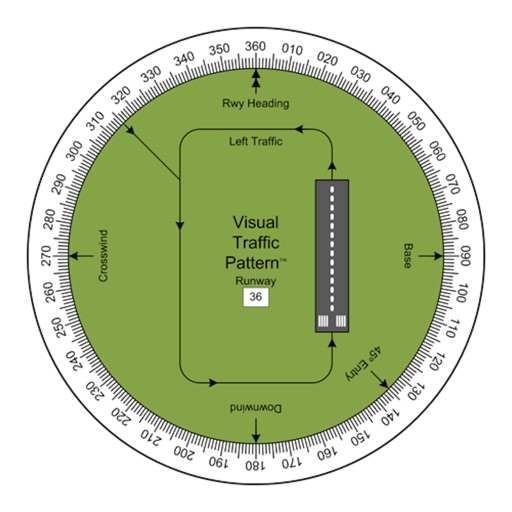
Visual Traffic Pattern
Arthur Varrassi
View runway patterns with finger rotation
Allows pilots to view runway patterns with finger rotation. Display includes left and right patterns, crosswind, downwind, base, and 45-degree entry headings. Magnetic runway orientation matches aircraft heading for approach visualization.



FindMaps: Search and Find Anything on a Map
motocode ltd
Search and find anything on map.
The app supplements the default iOS Maps app. It displays businesses, stations, streets, locations, and monuments on Apple Maps and provides walking or driving directions.


Japan Architecture Map
Kentaro Tsukuba
Explore and discover sites
Explore detailed information about contemporary Japanese . View over 15,000 sites and 2,000 architects. Learn about major and hidden works. Filter by architect, location, or style. Save favorites and access historical context.


Mappa - Watch Maps
Nick Romano
Track workouts, view metrics, export routes
Record workouts with heart rate, speed, elevation gain, and other metrics. Import and export GPX and FIT files. View offline with custom tiles. Overlay routes from GPX, FIT, KML, or GeoJSON files. Generate walking and cycling directions.

NRST
Toonsy Net
Airport information for any aircraft.
The app displays airport information including distance, field elevation, and required descent rate. It shows the user's current speed, course, altitude, and vertical speed, updating all data in real time.

Sirca Navigation
On the way, LLC
Navigate with turn-by-turn guidance
Navigate using turn-by-turn directions for driving, walking, or biking. Add stops along the route. Search for destinations in map view, list view, or both. Toggle between views for easy route planning.


Altimeter GPS & Real Altitude
LionsApp di Nallbati Elton
Measure altitude with GPS signal.
The app displays real-time altitude in meters or feet using a GPS signal. It automatically detects the user's location and shows altitude, name, address, latitude, and longitude on a map.





How we rank alternatives
Apps are ranked by functional similarity, category fit, rating confidence, and popularity.