

Apps Like PlaneTour for iPhone and iPad
PlaneTour screenshots
Ranked alternatives
Showing 321–340 of 1,000 ranked alternatives.

My-Location
Ken Muehring
Capture and share current GPS location.
The app captures the user's current GPS location and sends it by text or email. A link within the message displays the location on a map.

Garmin TXi Trainer
Digital Cyclone
Explore flight displays and engine systems
Learn to navigate flight displays and engine systems through simulated touch and bezel interactions. Explore HSI Map zoom gestures and split-screen PFD/MFD modes. Familiarize with interface elements before actual use.


ZapAtlas ™ - EMF Map
Paul Warner
Explore power-line maps and estimate EMF exposure
Explore power-line maps to estimate EMF exposure in milligauss units. Search addresses globally to access over 20 million power-line objects. Create pins to save and revisit favorite locations.


GenAv CoPilot
Sam Greaves
Plan flights, calculate fuel, track routes
Plan flights with detailed aircraft profiles and radio frequency access. Calculate fuel requirements and flight times. Manage pre-flight checklists and weather data. Track in-flight performance and adjust routes as needed.


Gps Area Calculator: Land Calc
Liam Sammy
Measure area, distance, and perimeter
Measure areas, distances, and perimeters with precise pin placement. Mark and save measurements, name and group them for easy access. Share measured maps with colleagues directly.

AR Compass 3D
Hangzhou OrangeJuice Technology Co., Ltd.
Navigate with AR and directions
Uses AR to display directions in real environment. Mark locations, addresses, and altitudes in surroundings. Record and screenshot navigation moments. Requires location services for accurate functionality.

Speedometer & Trip Logging
Hans Schneider
Track , distance, and altitude
Displays current , distance, direction, and altitude in MPH, KM/H, and KNOTS. Shows decimal values. Tracks top and average . Records and altitude data for the last few hours. Supports iPhone and iPad. Includes "speak " feature for audio feedback.

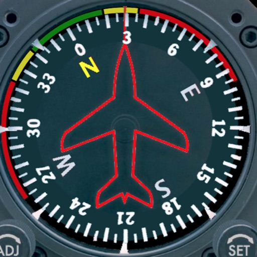
Aircraft Heading
Sean Flanagan
Track with realistic indicator
Displays a photorealistic -style indicator with both analog and digital readouts. Users can toggle rotation lock, simulate the instrument indoors, and view improved graphics. Supports latest iOS versions and includes bug fixes.




iBal Rotary
AirSpayce Pty Ltd
Calculate weight and balance for helicopters
Calculate helicopter weight and balance by entering load data. Check against type-specific CG limits and load station constraints. View graphical displays of weight distribution. nd send mission manifests via email.



How we rank alternatives
Apps are ranked by functional similarity, category fit, rating confidence, and popularity.