Plan metro routes with detailed time, fare, and step-by-step directions. View accurate maps and real-time updates. Access offline functionality for areas without internet. Switch between 11 languages.
Create and share by drawing routes and adding markers for campsites and start points. Collaborate with others to edit and view in real time. Navigate trails, track progress, and receive turn-by-turn directions.
The app allows users to create and edit information in OpenStreetMap. Users can add points of interest, streets, paths, buildings, and bodies of water, with full undo/redo support and offline capabilities.
Navigation provides functionality for directional guidance. Displays current direction and . Tracks movement and offers map integration for route planning. Allows users to set waypoints and navigate between locations.
Create visual content with templates for social media, logos, posters, and banners. Add text, images, and graphics. Export designs in multiple formats and share directly. No skills required.
Allows users to faces in photos and videos. Partial lets users customize the area. AI-powered technology enables realistic swapping. Users can edit and share -swapped content directly.
Edit videos with overlays, aesthetic effects, and filters. Add sound and music. Create vlogs, social media reels, and cinematic clips. Export edited videos in various formats.
Create social media content using editable templates. Choose a template, add a photo, and customize the design in a few clicks. Preview templates by long-pressing in the main menu. Share stories or posts directly.
Global with satellite imagery and topographic details. Explore nearby locations and access real-time data. Zoom in for detailed views and switch between map and modes. Track locations and save favorites for future reference.
Locate bus stops and view accurate departure times for routes. Search for line information, stations, and Rav-kav top-up locations. Get navigation directions using public transportation in Israel.
Turn photos into cartoons using AI-powered effects. Pixelate images for pixel art styles. Remove and replace backgrounds instantly. Add rounded borders for profile pictures. Export edited photos in various formats.
Track altitude with real-time measurements. Use a sensitive compass for accurate direction. Capture latitude and longitude data via camera. Monitor atmospheric pressure and magnetic field readings. Check real-time location data and sync with maps.
AI companions for unlimited conversations. Engage in romantic dialogues AI-generated characters. Share personal thoughts and aspirations in a secure environment. Provide feedback to influence AI behavior.
Convert photos into artistic styles like caricature, stylized portraits, and virtual backgrounds. Extract portraits and replace backgrounds with customizable options. Create magazine covers and animated themes. Share edited images directly.
Create custom labels using templates and design tools. Edit text, add images, and choose from various formats. Save and labels directly. Design offline with a user-friendly interface. Share labels via email or social media.
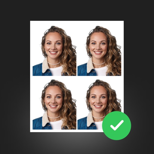
Create professional ID photos with AI tools. Automatically detect faces and remove backgrounds. Resize and crop portraits to fit official sizes. Support multiple countries' requirements. Generate printable -sized images for children and adults.
Create art using AI-powered tools to transform text and photos into visual designs. Edit and refine artwork with advanced features. Access unlimited creation tools and exclusive content with a premium subscription.