Displays real-time device orientation relative to magnetic fields. Switch between true and magnetic North. Shows location coordinates, course, speed, and altitude. Tracks movement and provides directional data.
Plan using offline and save them to My Map. Pin points of interest with descriptions and photos. Navigate existing or to any location. Record trips and display elevation graphs. Export as .gpx files. Integrate with Garmin. Buy professional .
The app calculates the shortest distance or distance with a constant bearing between two locations. Users can select current location, enter coordinates, or choose from a database.
Displays wind rose and location details including name, latitude, longitude, and altitude in meters or feet. Saves position data for any global location. Requires location services to detect geographical position.
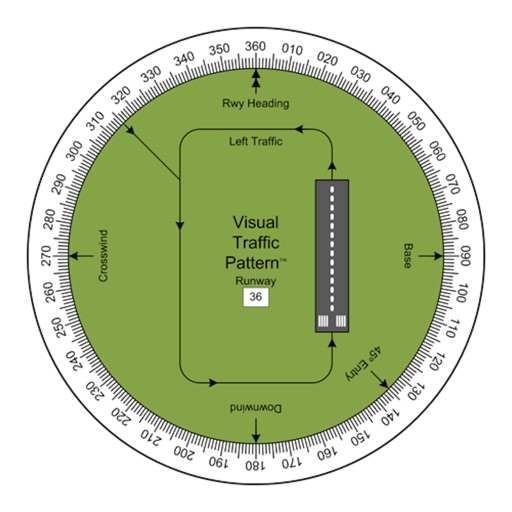
Allows pilots to view runway patterns with finger rotation. Display includes left and right patterns, crosswind, downwind, base, and 45-degree entry headings. Magnetic runway orientation matches aircraft heading for approach visualization.