Capture photos with advanced AI enhancements. Edit images using beauty filters and portrait modes. Create 3D figurines and custom avatars from photos. Share edited content directly. Sync with social media platforms.
The app helps users find nearby places within a two-kilometer radius, including restaurants, bars, and hotels. Users can search using Apple Maps or Foursquare and navigate to selected locations.
Track the sun’s and movement with real-time data tailored to your location, even offline. Analyze sunlight and shadow patterns for specific times and locations. Measure solar angles and predict sunrise and sunset times.
Navigate trails and routes for hiking, biking, and running. Access detailed maps of national parks and coastal paths. Find local neighborhoods and new trails. Plan routes with turn-by-turn directions. View elevation profiles and track progress.
Find campsites, campgrounds, and caravan parks across and New Zealand. Filter by location, facilities, and availability. Book campsites directly and receive confirmation emails. View maps and directions to sites.
Create custom maps with selectable locations and detailed comments. Add event logistics and local recommendations. Share maps via link for guests to navigate efficiently.
Check weather, wind, wave, and tide for any offshore location up to 16 days in advance. Save unlimited favorite points for quick access. Track real-time conditions and plan ocean activities.
Book rides, track trips, and receive notifications
Book rides by tapping your phone. View real-time tracking of your vehicle. Receive notifications about your ride status. Choose pickup location from curb or designated Flex area. Share ride with others. Confirm drop-off at curb.
View trail with detailed route information and park amenities. Search for hiking or running trails in Rochester and the Finger Lakes region. Access professional trail data and explore park features directly on your device.
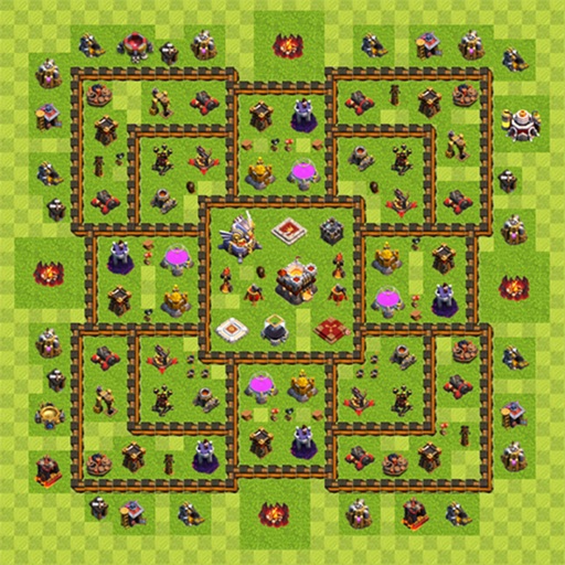
Share and discover Clash of Clans and strategies. Upload and view maps categorized by hall levels. Access hybrid designs and track troop placements. Export and share maps with other players.
View nearby cell towers for 5G, 4G, 3G, and 2G networks on an interactive map. Access tower details including ID, signal strength, and network provider. Tap to get directions to specific towers.
Book rides by tapping the to connect with others heading in the same direction. Track your driver in real time. Split costs automatically. Access routes and schedules for shared trips. Receive updates on ride status and estimated arrival times.
The app provides up-to-date arrival times based on GPS location of streetcars and buses. It also offers real-time location tracking and push notifications for service interruptions.
Explore detailed worldwide and topographic contour for outdoor navigation. Access offline without data roaming. Use voice-guided routing and view travel guides. Unlock unlimited offline with an in- purchase. Always access Africa Standard for free.
Report vehicle towing incidents, retrieve car locations, and access real-time community alerts. View high-risk towing areas. Learn local towing regulations and vehicle recovery steps. Share towing activity with others.
KUPERTINO BIL. YAZ. HALIL IBRAHIM KARAHAN SAFFET ARSLAN MUSTAFA AYTEN MUHAMMET YALCIN OZDEMIR K. S.
Record videos and photos
Record photos and videos with palettes, night vision enhancements, and infrared moods. Adjust intensity and contrast to enhance visuals. Switch between , night vision, and infrared modes instantly.
Adjust using AI analysis of live camera previews. Display Kelvin temperature values. Measure ambient light conditions without external sensors. Save and compare settings for different lighting scenarios.