

Apps Like Speedymeter for iPhone and iPad
Speedymeter screenshots
Ranked alternatives
Showing 381–400 of 1,000 ranked alternatives.

FMC
Idea Bits Latvia AS
Track vehicles, manage routes, monitor assets
Track vehicles and assets in real time with route history and speed monitoring. View driver activity, including driving time, distance, and rest periods. Predict tachograph data to manage compliance and schedule efficiently.

Localscope - Find places and people around you
Cynapse India Pvt. Ltd.
Explore locations, nearby , and access real-time
Explore geo-tagged information from local search engines, social networks, and media sharing services. nearby , , and events. View real-time updates and interact with shared content.


Route Scout - GPS Topo Mapper
Joseph Bartels
Record hikes and track routes
Record outdoor activities with topographic maps, waypoints, and elevation tracking. Log mileage, speed, time, and moving averages. Set breaks and receive audio alerts for splits and off-trail notifications. Import GPX files and auto-follow last .


Street View Live Satellite Map
Uchadadiya Nirali
Explore streets and landmarks with 360° views
Explore streets and landmarks with 360° panoramic views and detailed maps. Plan routes, search for nearby locations, and and terrain imagery. Navigate with real-time map updates and interactive -level perspectives.

Evaluway
Blue Meridian International Inc.
Plan routes to save fuel and reduce
Plan routes to minimize fuel consumption, reduce CO2 emissions, and save costs. Calculate fuel usage and compare multiple routes. Provide real-time traffic updates and suggest optimal departure times.

Compass Pro - Aircraft
LionsApp di Nallbati Elton
Track position with wind rose and coordinates
Displays wind rose and location details including name, latitude, longitude, and altitude in meters or feet. Saves position data for any global location. Requires location services to detect geographical position.

Field Area Measure+
Arda Sen
Measure land, map areas, record coordinates
Measure distances, perimeters, and areas by placing pins on a map. Calculate dimensions and save measurements. Share results via email or export as a file. Sync with other devices for collaborative projects.
Scenic Map Grand Canyon
Mark Granger
Explore landscapes in three dimensions.
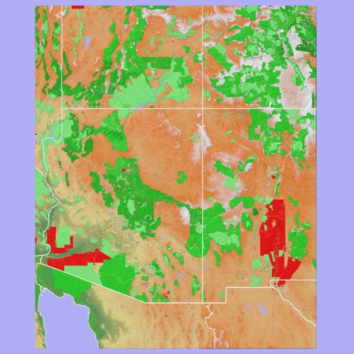
The app provides 3D topographic maps for iPad and iPhone. Vector map data is contained within the app for offline use, supporting navigation in various environments.



BlindSquare
MIPsoft Oy
Navigate locations with voice guidance
Navigate using real-time audio guidance and location tracking. Access indoor and outdoor maps. Set destinations and receive step-by-step directions. Receive alerts for obstacles and changes in surroundings.
Liverpool Airport + Tracker
Renji Mathew
Track flights and manage trips easily.
The app provides flight tracking for Liverpool Airport, including live arrival and departure boards. It offers flight status updates and tools to find alternate flights if a flight is delayed or cancelled.


MiCycle Pro
OXiGENATOR LLC
Track routes on bike or trainer
Track cycling routes with GPS/GLONASS for location, speed, and elevation. Monitor power via Bluetooth or ANT+ sensors. Record cadence and compensate for single-side power meters. Save and review ride data. Sync with Apple Health.


Västkustens Naturhamnar
Svenska Kryssarklubbens Västkustkrets
Navigate west coast natural harbors safely.
The app displays navigation information for over 300 natural harbors along the west coast. It shows depths, swells, 2-meter depth curves, and mooring eye locations within aerial photos.
How we rank alternatives
Apps are ranked by functional similarity, category fit, rating confidence, and popularity.