
Footpath Route Planner
Half Mile Labs LLC
Plan and navigate custom routes easily.
The app measures distances and elevations, then navigates with turn-by-turn directions. Users can plan and save custom routes for various activities and adventures.
Showing 1–20 of 1,000 ranked alternatives.
Half Mile Labs LLC
Plan and navigate custom routes easily.
The app measures distances and elevations, then navigates with turn-by-turn directions. Users can plan and save custom routes for various activities and adventures.

晓溪 张
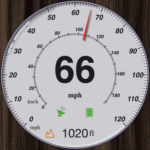
Track speed with dual scales and unit
GPS measures and displays speed for walking, jogging, cycling, cars, boats, trains, and airplanes. Users can select display units and choose between two scales. Trip recording and average speed tracking are available.

Waterspeed Technologies Limited
Progress and analyze water sports sessions
Water sports sessions with speed, distance, heart rate, wind, and stroke data. Log activities like sailing, wingfoiling, and kayaking. Analyze performance trends and monitor progress over time. Sync data across devices for consistent tracking.

FITAPP GmbH
Track workouts, log weight, and record GPS
Track distance, duration, and pace using GPS. Log weight with detailed history. Receive voice feedback on time, calories, distance, and speed. Share workout photos in the feed. View weekly and monthly statistics. Automatically count steps.

Abvio Inc.
Track rides, measure stats, plan training
Track metrics like speed, distance, cadence, power, heart rate, and elevation. Customize training plans and view live biking data. Sync with Apple Watch. Log workouts for , running, hiking, and other activities.

AllTrails, Inc.
Plan outdoor trips and track your journey
Find trails suitable for hiking, biking, running, or walking. Filter by accessibility options like dog-friendly, kid-friendly, or stroller-friendly. Get turn-by-turn navigation and detailed trail information.

Abvio Inc.
Track steps, distance, and elevation
Tracks and activities with maps, graphs, splits, intervals, and laps. Records data including zones and training plans. Provides announcements and syncs with Apple Watch and iCloud.

Hearn Apps, LLC
Companion for hiking camping climbing flying
The app uses the device's GPS to save and display locations. Users can share their location and altitude with friends.

Outside Television Inc
Track rides, log miles, explore trails
Track bike rides GPS to map routes and record performance stats. Log distance, speed, and elevation. Share rides a community. Set and monitor cycling goals. Sync data across devices. Explore new trails and view detailed maps.

Pacer Health, Inc
Track steps, plan routes, and stay active
Tracks steps, flights climbed, calories burned, distance, and active time regardless of phone placement. Offers personalized walking plans, outdoor routes, and progress insights. Syncs data with Apple Health.

Abvio Inc.
Track runs with maps and splits
Tracks and cycling activities with maps, splits, intervals, and laps. Displays performance graphs, zones, and training plans. Syncs with Apple Watch and iCloud.

Sven Navez
Track data and visualize insights
View data from Apple in a centralized dashboard. Track daily exercise time, step count, walking and running distance, stairs climbed, stand hours, active and resting energy burned, and water intake.

Strava Inc.
Record workouts and share activity
Record workouts including runs, rides, hikes, and yoga across over 30 sports. Track distance, time, and pace. Share activities with friends. Discover routes using de-identified data or create custom ones. Set goals and view performance metrics.

Suunto Oy
Track , analyze performance, discover routes
Track running, cycling, hiking, and over 90 with GPS data. Analyze performance metrics and save routes. View heatmaps to discover new paths. Switch between terrain and satellite maps for route planning. Sync data with Apple Health.

Azumio Inc.
Track activities, train, and connect
Track workouts, monitor heart rate, and log daily activities. Access personalized training plans and meal guides tailored to diets like Keto, Paleo, and Vegan. Connect with a global fitness community and receive expert insights.

Unicom TOV
Show speed, switch to HUD mode
Displays current speed, longitudinal and transverse slope, and ascent/descent percentages. Switch between normal and HUD modes for windscreen reflection. Verify vehicle speed during cycling, running, flying, or sailing.

Kirway LLC
Access weather, wind, and no-fly zone data
Access real-time weather radar and wind maps to plan flights . View rain radar and no-fly zone data. Check wind patterns and atmospheric conditions. Navigate flight areas with accurate geographic insights.

Apps are ranked by functional similarity, category fit, rating confidence, and popularity.