Navigation allows users to view detailed maps with higher resolution and more street names. Display four times more map content on the screen. Includes sharper satellite imagery and points of interest. Adjust map scale for comfort.
The app measures distances, perimeters, and areas with precision over satellite images. It calculates surface areas, dimensions for fencing, and more without needing to be on location.
View maps in three different styles with six customizable settings. Long press to access map options. Search for locations and streets. Navigate with fullscreen map interface.
View and navigate topographic maps offline with full resolution. Import Geospatial PDFs and align maps accurately. Rotate maps and reference them over Apple Maps. Track location and zoom in for detailed terrain features.
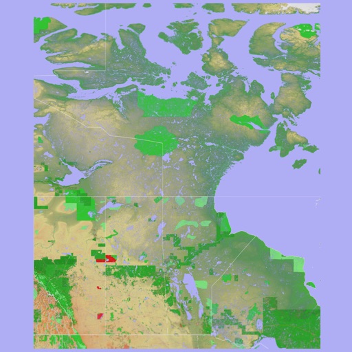
The app provides over 70,000 topographical maps from Natural Resources Canada and USGS. Users can view maps and search for over a million features without a network connection after downloading.
Displays current location using GPS on a high-resolution topo map. Includes an index to over 1,000 locations in Utah’s Central mountains. Allows users to navigate trails, view elevation data, and access detailed route information.
Measure distances and angles using a rangefinder and inclinometer. View real-time compass direction and GPS location. Overlay maps and take geo-tagged photos or videos. Calculate navigation routes and track elevation changes.
View 3D for hiking, skiing, trekking, paragliding, and mountaineering. Download and use USGS offline for navigation without internet. Track location with GPS. Display topographic data and elevation changes. Share map locations and routes.
Provides offline maps of the entire United States. Displays roads, terrain, streams, lakes, and landmarks. Works without cell signal. Allows zooming and panning. Includes compass and scale. Supports saving and sharing map views.
Allows users to browse , search locations, save favorites, and use turn-by-turn . Premium subscription enables traffic-aware routing, activity recording, offline , and elevation map views for terrain clarity.
Explore maps with detailed satellite views, hiking trails, and topography. Navigate transport networks and view railway routes. Access terrain analysis and seas. Customize map layers for OpenStreetMap and tile-based maps.
Allows users to search for tracks, huts, and campsites across New Zealand. It provides essential track details and three map views including LINZ Topo and satellite. Users can save completed trips and wishlist items for personalized maps.
Track location and movement with GPS. View USGS, US Forest Service, and Canadian . Log trails and waypoints. Navigate offline in areas without cell signal. Display elevation and terrain details. Share route data and historical tracks.
Locations with a single tap for precise GPS marking. Share saved locations with contacts. Access locations online or offline. View saved places on a map. Edit or delete saved locations.
The app provides location information, including address and coordinates, with a compass and map view. It also features a seismometer to alert users of earthquakes and allows sharing of precise locations via email or message.
Distances between waypoints or calculate surface areas using map polygons. Set waypoints by tapping and holding. Choose units like kilometers, miles, or nautical miles. Access settings to change map type or view the manual.