The app provides aviation navigation for Southern Africa with a GPS moving map and detailed airfields database. It includes airspace information, flight planning, and an E6B calculator for enhanced situational awareness.
by Aviation.Direct (Pty) Ltd★ 5.05 ratingsNavigationFreeData updated 2026-10-01
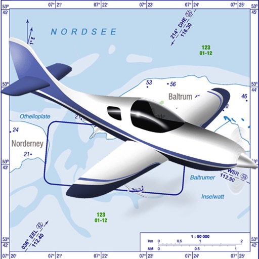
VFR charts for German airfields and helicopter sites.
The app provides VFR charts for German airfields and helicopter landing sites, including French AIP maps. Users require an account for content downloads and map updates, with monthly updates available for a fee.
Navigation provides offline global maps for iPhone and iPad. Users can draw routes, view elevation profiles, and access detailed terrain maps without internet. Hikers and cyclists benefit from specialized route networks and clear map details.
Track cycling speed, distance, and route in real time. Choose from three display modes: digital, analog, or map. View ride history and manage past rides. Automatically stop the timer when movement stops. Swipe to navigate between screens.
View real-time traffic incidents and camera feeds from Highway Patrol. Check nearest traffic updates using the today screen widget. Access dark mode interface. Share traffic camera images on Twitter.
The app records outdoor activities and converts them into interactive trails. These trails change color and trigger alerts if users wander off course, offering navigation assistance to waypoints.
View real-time conditions and camera feeds across . Access live data from ODOT, including 750+ cameras. Save favorite cameras for quick access. Use the today screen widget to see nearby incidents. Enable dark mode for iOS13+ devices.
Access HD for USA, Canada, UK/Ireland, Germany, Netherlands, and European rivers. View NOAA vector , freshwater maps, and USACE inland river maps with bathymetry. Create or import GPX/KML routes. Use voice prompts for navigation.
Plan routes, share locations, and navigate off-grid
Plan and execute missions with real-time GPS navigation, coordinate teams through integrated communication tools, and manage tasks with mission-specific software. Track location, receive alerts, and access offline maps for remote operations.
Convert between decimal degrees, degrees and decimal minutes, and degrees-minutes-seconds. Display all three formats simultaneously. Enter in any format for instant conversion.
The app provides 2D and 3D flight data visualization, downloadable map data, and live tracking support. It calculates XC points, supports common file formats, and visualizes airspaces and thermals.
GPS OS allows users to determine their location on Ordnance Survey maps of Great Britain and Ireland without needing a phone signal. It provides high-accuracy positioning using OSTN15 transformation data.